
|
Weather Alert |
| Forsyth County, NC | |||||||||
|
|
||||||||
|
Canceled 9/21/26 5:56 PM Severe Thunderstorm Warning issued September 21 at 5:43PM EDT until September 21 at 6:00PM EDT by NWS Raleigh NC At 542 PM EDT, a severe thunderstorm was located 5 miles northwest of High Point moving south at 10 mph. HAZARD...60 mph wind gusts. SOURCE...Radar indicated. IMPACT...Expect damage to roofs, siding, and trees. Locations impacted include... High Point, Kernersville, McLeansville, Jamestown, Lake Townsend Marina, Lake Townsend, Lake Jeanette Marina, Monticello, and Lake Brandt. This includes the following highways... Interstate 40 between Mile Markers 195 and 222. Interstate 73 between Mile Markers 98 and 103. Interstate 74 between Mile Markers 56 and 71. 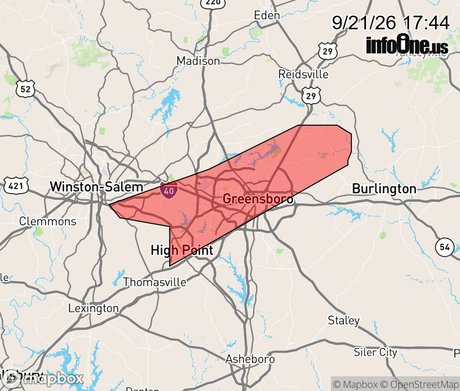 |
|||||||||
 Why aren't you using the InfoOne app? Why aren't you using the InfoOne app?
Stay abreast of information affecting your community! InfoOne tracks real-time information such as:
InfoOne currently supports over 100 communities in NC, VA and WV, and our coverage area is steadily growing. It's free! Install the InfoOne app today and see what you've been missing. |
|||||||||