|
|
Weather Alert |
| Franklin County, OH | |||||||||
|
|
||||||||
|
Canceled 4/22/26 8:00 PM Special Weather Statement issued April 22 at 7:30PM EDT by NWS Wilmington OH At 730 PM EDT, a strong thunderstorm was located near Delaware, moving southeast at 20 mph. HAZARD...Winds gusts up to 35 mph, half inch hail, and very heavy rain. SOURCE...Radar indicated. IMPACT...Gusty winds could knock down tree limbs and blow around unsecured objects. Hail may cause minor damage to vegetation. Visibility will be poor and hydroplaning is possible. Locations impacted include... Columbus, Westerville, Delaware, Gahanna, Worthington, Powell, Johnstown, Sunbury, Utica, Minerva Park, Polaris, Easton, New Albany, Galena, Ostrander, Riverlea, Hartford, Alum Creek State Park, Olive Green, and US Route 62 at State Route 661. This includes I-71 in Ohio between mile markers 115 and 138. If outdoors, consider seeking shelter inside a sturdy building. Motorists should slow down and use extra caution. To report hazardous weather conditions, go to our website at weather.gov/iln and submit your report via social media, when you can do so safely. 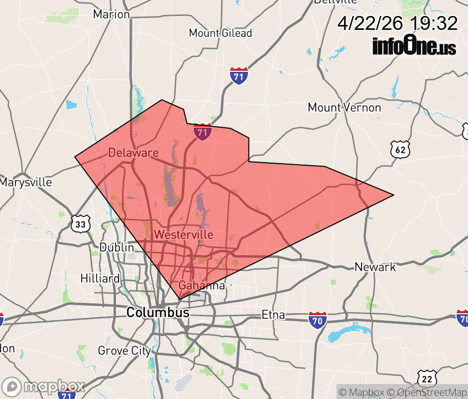 |
|||||||||
 Why aren't you using the InfoOne app? Why aren't you using the InfoOne app?
Stay abreast of information affecting your community! InfoOne tracks real-time information such as:
InfoOne currently supports over 100 communities in NC, VA and WV, and our coverage area is steadily growing. It's free! Install the InfoOne app today and see what you've been missing. |
|||||||||