
|
Weather Alert |
| Franklin County, OH | |||||||||
|
|
||||||||
|
Canceled 7/21/26 4:45 PM Special Weather Statement issued July 21 at 4:10PM EDT by NWS Wilmington OH At 410 PM EDT, a strong thunderstorm was located near Baltimore, moving east at 45 mph. HAZARD...Wind gusts up to 45 mph. SOURCE...Radar indicated. IMPACT...Gusty winds could knock down tree limbs and blow around unsecured objects. Locations impacted include... Columbus, Lancaster, Reynoldsburg, Pickerington, Heath, Pataskala, Canal Winchester, Baltimore, Buckeye Lake, Hebron, Bremen, Millersport, Pleasantville, Harbor Hills, Fairfield Beach, Thornport, Etna, Royalton, Lithopolis, and Thurston. This includes I-70 in Ohio between mile markers 111 and 142, and near mile marker 144. If outdoors, consider seeking shelter inside a sturdy building. A Severe Thunderstorm Watch remains in effect until 800 PM EDT for central Ohio. To report hazardous weather conditions, go to our website at weather.gov/iln and submit your report via social media, when you can do so safely. 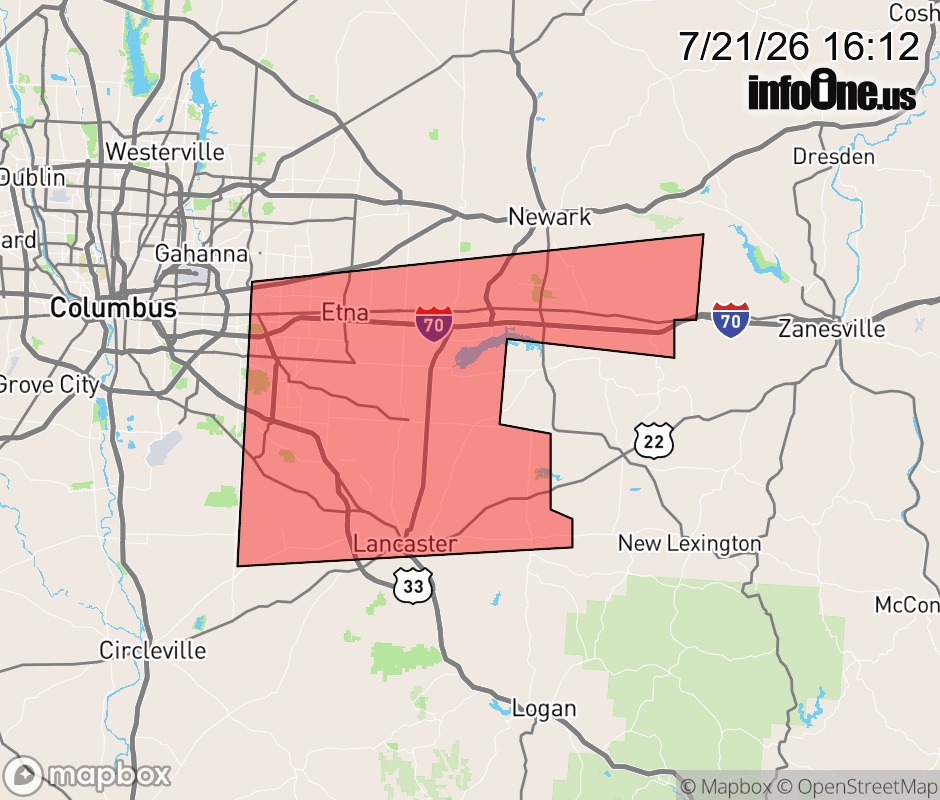 |
|||||||||
 Why aren't you using the InfoOne app? Why aren't you using the InfoOne app?
Stay abreast of information affecting your community! InfoOne tracks real-time information such as:
InfoOne currently supports over 100 communities in NC, VA and WV, and our coverage area is steadily growing. It's free! Install the InfoOne app today and see what you've been missing. |
|||||||||