|
|
Weather Alert |
| Buncombe County, NC | |||||||||
|
|
||||||||
|
Canceled 6/30/26 7:35 PM Severe Thunderstorm Warning issued June 30 at 6:55PM EDT until June 30 at 8:00PM EDT by NWS Greenville-Spartanburg SC SVRGSP The National Weather Service in Greenville-Spartanburg has issued a * Severe Thunderstorm Warning for... Northeastern Transylvania County in western North Carolina... Northwestern Henderson County in western North Carolina... South central Buncombe County in western North Carolina... * Until 800 PM EDT. * At 655 PM EDT, a severe thunderstorm was located 8 miles south of Downtown Asheville, or near Bent Creek, moving southwest at 15 mph. HAZARD...60 mph wind gusts and quarter size hail. SOURCE...Radar indicated. IMPACT...Minor hail damage to vehicles is expected. Expect wind damage to trees and power lines. * Locations impacted include... Biltmore Forest, Bent Creek, B.R. Parkway-Mount Pisgah To The Nc Arboretum, Skyland, Avery Creek, Forge Mountain, North Transylvania, Mills River, Asheville Airport, and B.R. Parkway-Nc Arboretum To East Asheville. 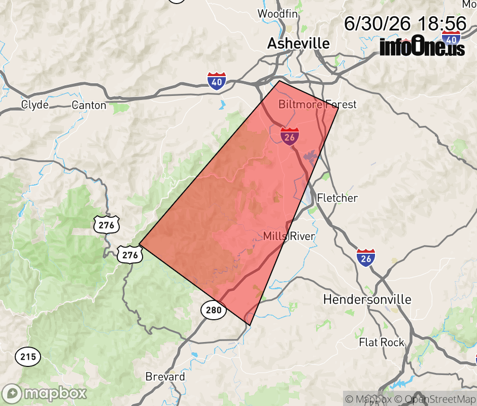 |
|||||||||
 Why aren't you using the InfoOne app? Why aren't you using the InfoOne app?
Stay abreast of information affecting your community! InfoOne tracks real-time information such as:
InfoOne currently supports over 100 communities in NC, VA and WV, and our coverage area is steadily growing. It's free! Install the InfoOne app today and see what you've been missing. |
|||||||||