|
|
Weather Alert |
| Wayne County, WV | |||||||||
|
|
||||||||
|
Canceled 6/6/25 4:44 PM Severe Thunderstorm Warning issued June 6 at 4:28PM EDT until June 6 at 5:00PM EDT by NWS Charleston WV SVRRLX The National Weather Service in Charleston West Virginia has issued a * Severe Thunderstorm Warning for... Northwestern Mingo County in southern West Virginia... Southwestern Lincoln County in central West Virginia... Northwestern Logan County in southern West Virginia... Southern Wayne County in western West Virginia... * Until 500 PM EDT. * At 427 PM EDT, a severe thunderstorm was located near Hode, or 11 miles east of Inez, moving east at 30 mph. HAZARD...60 mph wind gusts and quarter size hail. SOURCE...Radar indicated. IMPACT...Hail damage to vehicles is expected. Expect wind damage to roofs, siding, and trees. * Locations impacted include... Holden, Mount Gay-Shamrock, Harts, Dingess, Breeden, and Wilsondale. This includes Route 119 between mile markers 13 and 22. 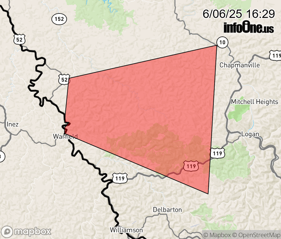 |
|||||||||
 Why aren't you using the InfoOne app? Why aren't you using the InfoOne app?
Stay abreast of information affecting your community! InfoOne tracks real-time information such as:
InfoOne currently supports over 100 communities in NC, VA and WV, and our coverage area is steadily growing. It's free! Install the InfoOne app today and see what you've been missing. |
|||||||||