|
|
Weather Alert |
| Guilford County, NC | |||||||||
|
|
||||||||
|
Canceled 6/6/25 10:30 PM Flood Advisory issued June 6 at 8:28PM EDT until June 6 at 10:30PM EDT by NWS Raleigh NC * WHAT... Urban and small stream flooding caused by excessive rainfall is expected. * WHERE... A portion of central North Carolina, including the following counties, Forsyth and Guilford. * WHEN... Until 1030 PM EDT. * IMPACTS... Minor flooding in low-lying and poor drainage areas. Ponding of water in urban or other areas is occurring or is imminent. * ADDITIONAL DETAILS... - At 828 PM EDT, Doppler radar indicated heavy rain due to thunderstorms. This will cause urban and small stream flooding. Between 0.5 and 1 inch of rain has fallen. - Additional rainfall amounts of up to an inch are expected over the area. This additional rain will result in minor flooding. - Some locations that will experience flooding include... Greensboro, Winston-Salem, High Point, Kernersville, Clemmons, Huntsville, McLeansville, Lewisville, Walkertown, Jamestown, Sedge Garden, Colfax, Oak Hollow Marina, Stanleyville, Pfafftown, Lake Brandt, Lake Jeanette Marina, Lake Townsend and Donnaha. - The Interstate 40 corridor from Winston-Salem to Greensboro. - http://www.weather.gov/safety/flood 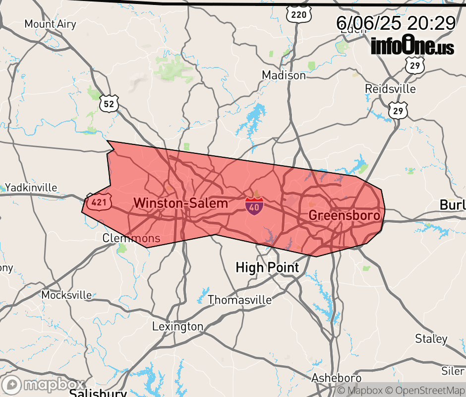 |
|||||||||
 Why aren't you using the InfoOne app? Why aren't you using the InfoOne app?
Stay abreast of information affecting your community! InfoOne tracks real-time information such as:
InfoOne currently supports over 100 communities in NC, VA and WV, and our coverage area is steadily growing. It's free! Install the InfoOne app today and see what you've been missing. |
|||||||||