|
|
Weather Alert |
| Kanawha County, WV | |||||||||
|
|
||||||||
|
Canceled 6/26/25 9:45 PM Special Weather Statement issued June 26 at 9:13PM EDT by NWS Charleston WV At 913 PM EDT, Doppler radar was tracking strong thunderstorms along a line extending from 6 miles northeast of Summersville to Gauley Bridge. Movement was northwest at 25 mph. HAZARD...Wind gusts up to 50 mph and half inch hail. SOURCE...Radar indicated. IMPACT...Gusty winds could knock down tree limbs and blow around unsecured objects. Minor hail damage to vegetation is possible. Locations impacted include... Summersville, Montgomery, Ansted, Smithers, Gauley Bridge, Pratt, Hawks Nest State Park, Widen, Bickmore, Muddlety, Indore, Swiss, Bentree, Calvin, Kesslers Cross Lanes, Drennan, Pond Gap, Canvas, and Mount Nebo. This includes Route 19 between mile markers 30 and 55. 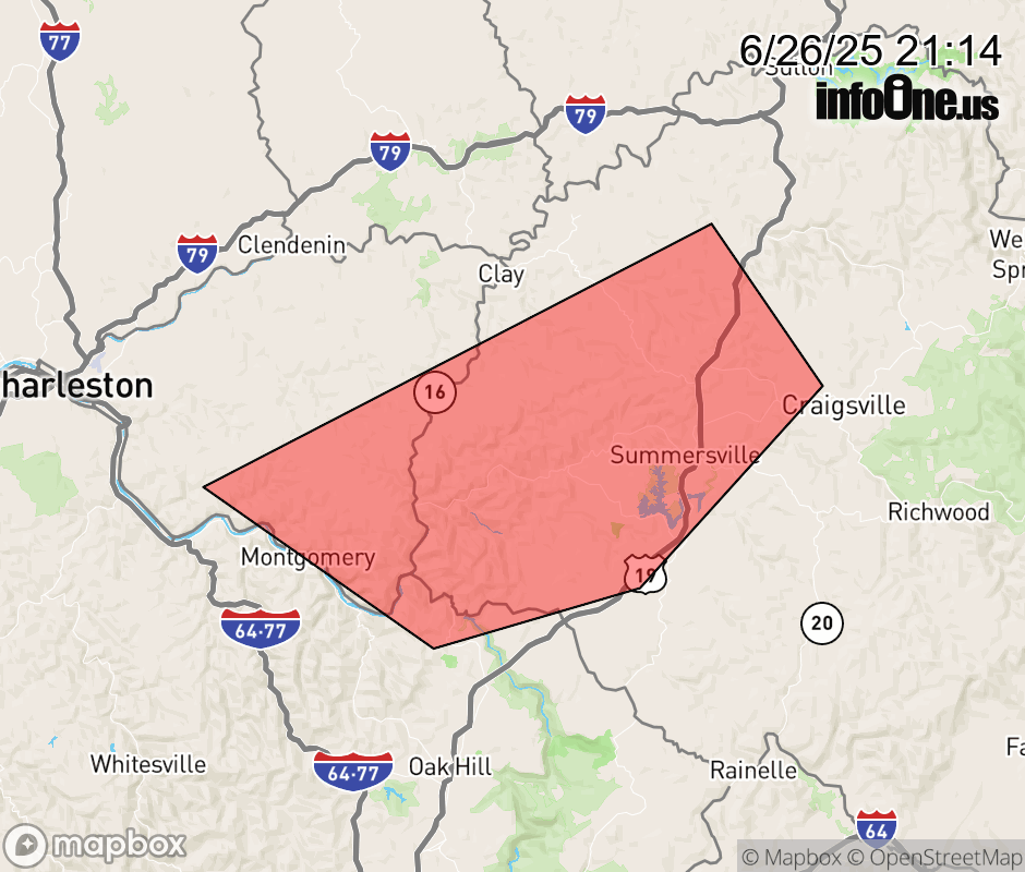 |
|||||||||
 Why aren't you using the InfoOne app? Why aren't you using the InfoOne app?
Stay abreast of information affecting your community! InfoOne tracks real-time information such as:
InfoOne currently supports over 100 communities in NC, VA and WV, and our coverage area is steadily growing. It's free! Install the InfoOne app today and see what you've been missing. |
|||||||||