|
|
Weather Alert |
| Forsyth County, NC | |||||||||
|
|
||||||||
|
Canceled 7/25/24 1:00 AM Special Weather Statement issued July 25 at 12:01AM EDT by NWS Raleigh NC At 1201 AM EDT, Doppler radar was tracking strong thunderstorms along a line extending from near Leasburg to 6 miles south of Bethany. Movement was northeast at 40 mph. HAZARD...Wind gusts up to 50 mph. SOURCE...Radar indicated. IMPACT...Gusty winds could knock down tree limbs and blow around unsecured objects. Locations impacted include... Greensboro, High Point, Burlington, Roxboro, Kernersville, Elon, McLeansville, Concord, Summerfield, and Gibsonville. 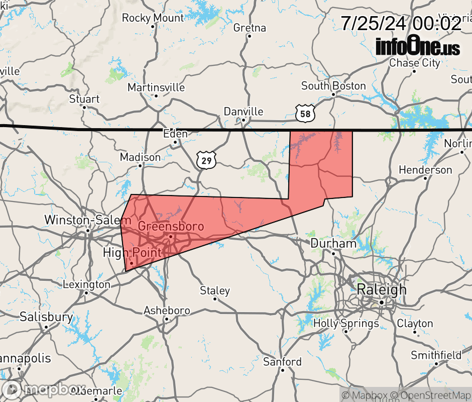 |
|||||||||
 Why aren't you using the InfoOne app? Why aren't you using the InfoOne app?
Stay abreast of information affecting your community! InfoOne tracks real-time information such as:
InfoOne currently supports over 100 communities in NC, VA and WV, and our coverage area is steadily growing. It's free! Install the InfoOne app today and see what you've been missing. |
|||||||||