|
|
Weather Alert |
| Lee County, NC | |||||||||
|
|
||||||||
|
Canceled 6/27/26 2:50 PM Severe Thunderstorm Warning issued June 27 at 2:36PM EDT until June 27 at 3:30PM EDT by NWS Raleigh NC SVRRAH The National Weather Service in Raleigh has issued a * Severe Thunderstorm Warning for... Northern Harnett County in central North Carolina... Northeastern Lee County in central North Carolina... Southwestern Wake County in central North Carolina... Southeastern Chatham County in central North Carolina... * Until 330 PM EDT. * At 235 PM EDT, severe thunderstorms were located along a line extending from 7 miles south of Pittsboro to near Sanford, moving east at 25 mph. HAZARD...60 mph wind gusts and penny size hail. SOURCE...Radar indicated. IMPACT...Expect damage to roofs, siding, and trees. * Locations impacted include... Cary, Sanford, Lillington, Fuquay-Varina, Angier, Apex, Holly Springs, Coats, Broadway, and New Hill. This includes US 1 between Mile Markers 72 and 101. 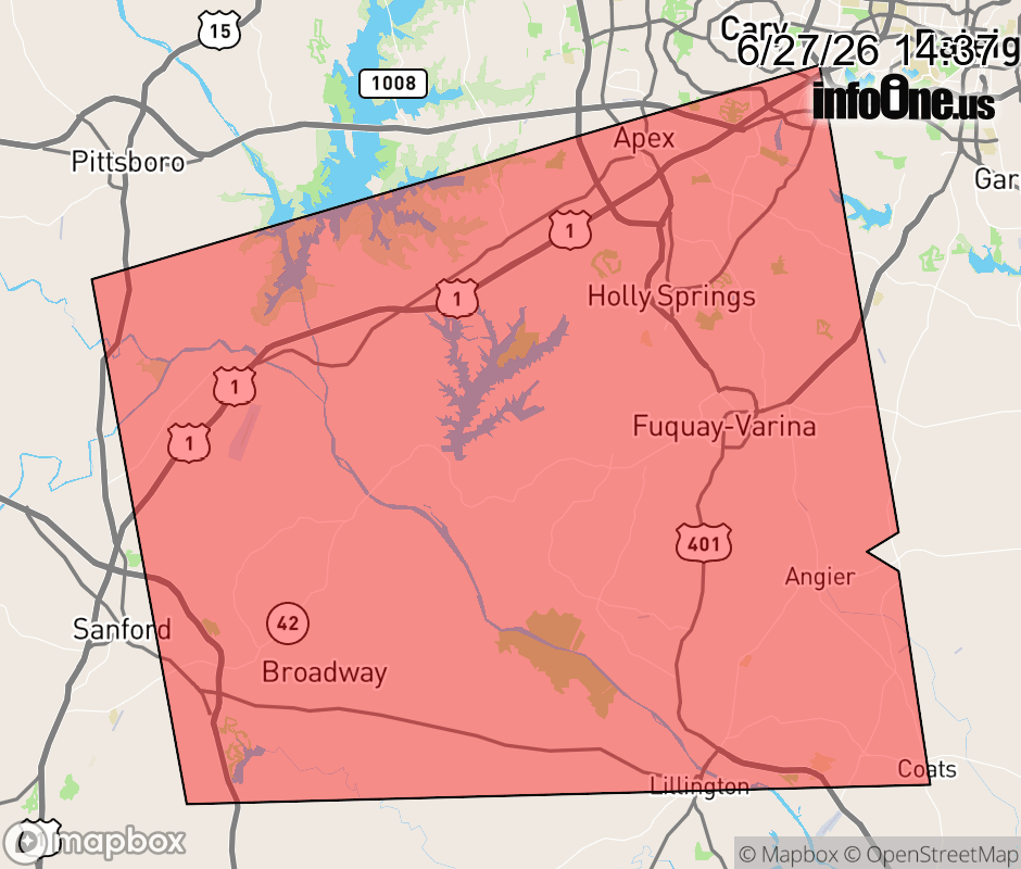 |
|||||||||
 Why aren't you using the InfoOne app? Why aren't you using the InfoOne app?
Stay abreast of information affecting your community! InfoOne tracks real-time information such as:
InfoOne currently supports over 100 communities in NC, VA and WV, and our coverage area is steadily growing. It's free! Install the InfoOne app today and see what you've been missing. |
|||||||||