|
|
Weather Alert |
| Franklin County, OH | |||||||||
|
|
||||||||
|
Canceled 7/25/25 6:04 PM Severe Thunderstorm Warning issued July 25 at 5:53PM EDT until July 25 at 6:30PM EDT by NWS Wilmington OH SVRILN The National Weather Service in Wilmington has issued a * Severe Thunderstorm Warning for... Southeastern Champaign County in west central Ohio... Southwestern Franklin County in central Ohio... Northwestern Pickaway County in central Ohio... Eastern Clark County in west central Ohio... Madison County in central Ohio... * Until 630 PM EDT. * At 553 PM EDT, a severe thunderstorm was located near Choctaw Lake, moving east at 20 mph. HAZARD...60 mph wind gusts. SOURCE...Radar indicated. IMPACT...Expect damage to trees and power lines. * Locations impacted include... Columbus, Hilliard, London, Jefferson, West Jefferson, Mount Sterling, South Charleston, Choctaw Lake, Lake Darby, Lisbon, Brighton, Lafayette, South Vienna, Midway, Harrisburg, Newport, Chenoweth, Georgesville, Madison Lake, and Darbydale. This includes the following Interstates... I-70 in Ohio between mile markers 66 and 91. I-71 in Ohio between mile markers 78 and 92. 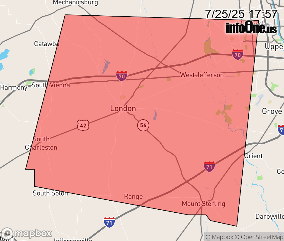 |
|||||||||
 Why aren't you using the InfoOne app? Why aren't you using the InfoOne app?
Stay abreast of information affecting your community! InfoOne tracks real-time information such as:
InfoOne currently supports over 100 communities in NC, VA and WV, and our coverage area is steadily growing. It's free! Install the InfoOne app today and see what you've been missing. |
|||||||||