|
|
Weather Alert |
| Franklin County, OH | |||||||||
|
|
||||||||
|
Canceled 3/22/26 11:00 PM Severe Thunderstorm Warning issued March 22 at 10:45PM EDT until March 22 at 11:15PM EDT by NWS Wilmington OH At 1045 PM EDT, a severe thunderstorm was located near West Jefferson, moving east at 50 mph. HAZARD...60 mph wind gusts and half dollar size hail. SOURCE...Radar indicated. IMPACT...Minor hail damage to vehicles is possible. Expect wind damage to trees and power lines. Locations impacted include... Columbus, Grove City, Upper Arlington, Hilliard, Bexley, London, Jefferson, West Jefferson, Mount Sterling, Ohio State University, Lake Darby, Whitehall, Grandview Heights, Obetz, Commercial Point, Urbancrest, Valleyview, Marble Cliff, Lafayette, and Harrisburg. This includes the following Interstates... I-70 in Ohio between mile markers 75 and 104. I-71 in Ohio between mile markers 83 and 110. 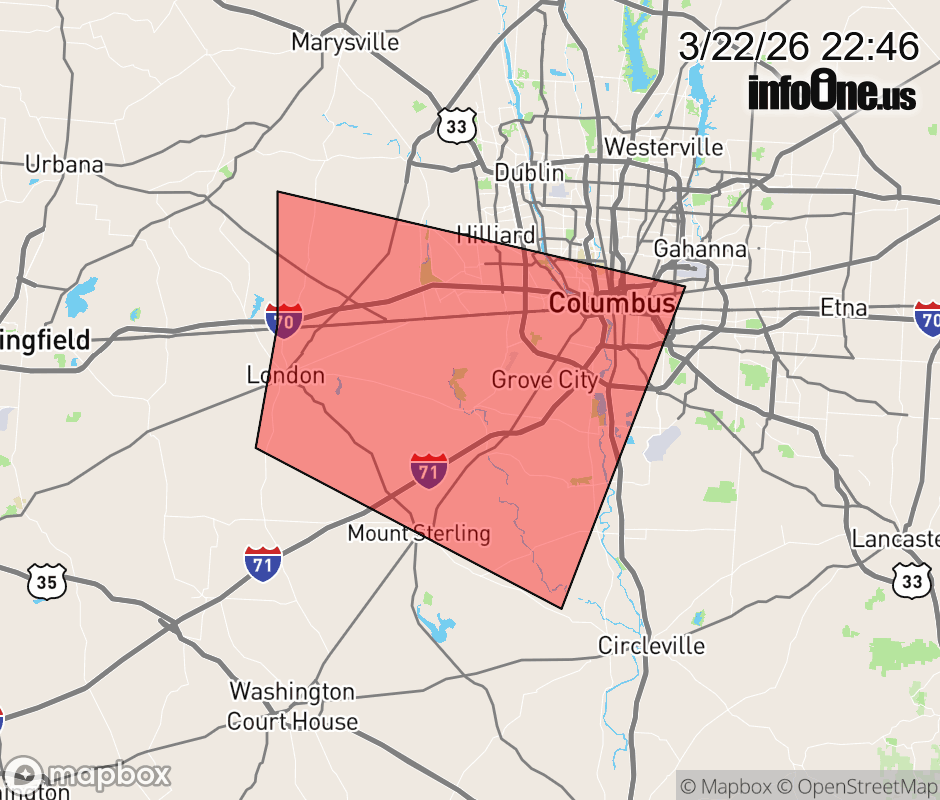 |
|||||||||
 Why aren't you using the InfoOne app? Why aren't you using the InfoOne app?
Stay abreast of information affecting your community! InfoOne tracks real-time information such as:
InfoOne currently supports over 100 communities in NC, VA and WV, and our coverage area is steadily growing. It's free! Install the InfoOne app today and see what you've been missing. |
|||||||||