|
|
Weather Alert |
| Kanawha County, WV | |||||||||
|
|
||||||||
|
Canceled 5/16/25 11:24 PM Severe Thunderstorm Warning issued May 16 at 11:04PM EDT until May 16 at 11:30PM EDT by NWS Charleston WV SVRRLX The National Weather Service in Charleston West Virginia has issued a * Severe Thunderstorm Warning for... Southern Putnam County in western West Virginia... Kanawha County in central West Virginia... Northeastern Lincoln County in central West Virginia... South central Roane County in central West Virginia... * Until 1130 PM EDT. * At 1103 PM EDT, a severe thunderstorm was located over St. Albans, or over Nitro, moving east at 50 mph. HAZARD...60 mph wind gusts and nickel size hail. SOURCE...Radar indicated. IMPACT...Expect damage to roofs, siding, and trees. * Locations impacted include... Charleston, Nitro, Jefferson, South Charleston, St. Albans, Dunbar, Hurricane, Sissonville, Marmet, Belle, Clendenin, Poca, Cross Lanes, Pinch, Alum Creek, Institute, Tornado, Coal Fork, Elkview, and Teays Valley. This includes the following highways... Interstate 79 between mile markers 1 and 23. Interstate 77 in West Virginia between mile markers 96 and 116. Interstate 64 in West Virginia between mile markers 35 and 57. West Virginia Turnpike between mile markers 90 and 95. Route 119 between mile markers 66 and 80. 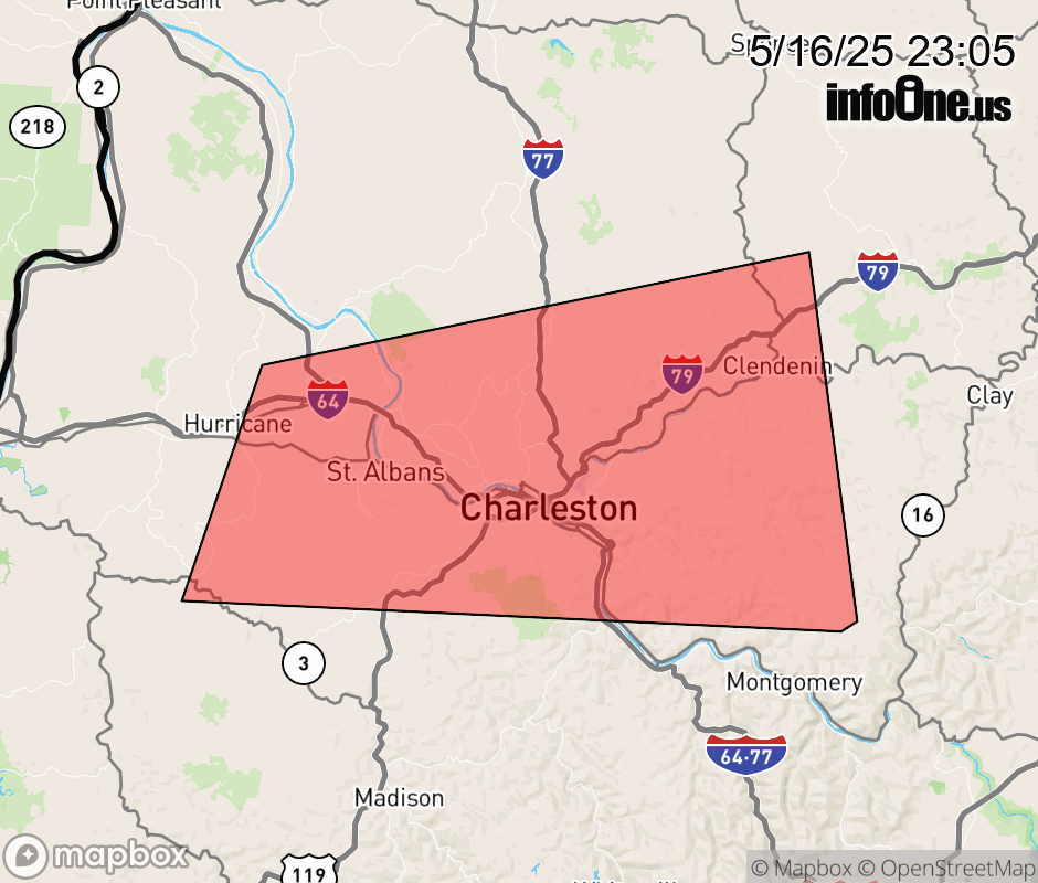 |
|||||||||
 Why aren't you using the InfoOne app? Why aren't you using the InfoOne app?
Stay abreast of information affecting your community! InfoOne tracks real-time information such as:
InfoOne currently supports over 100 communities in NC, VA and WV, and our coverage area is steadily growing. It's free! Install the InfoOne app today and see what you've been missing. |
|||||||||