|
|
Weather Alert |
| Franklin County, OH | |||||||||
|
|
||||||||
|
Canceled 3/22/26 8:25 PM Severe Thunderstorm Warning issued March 22 at 8:06PM EDT until March 22 at 8:45PM EDT by NWS Wilmington OH SVRILN The National Weather Service in Wilmington has issued a * Severe Thunderstorm Warning for... Northern Franklin County in central Ohio... Delaware County in central Ohio... Northwestern Licking County in central Ohio... Southeastern Union County in central Ohio... Northeastern Madison County in central Ohio... * Until 845 PM EDT. * At 805 PM EDT, a severe thunderstorm was located over Powell, moving east at 55 mph. HAZARD...Quarter size hail. SOURCE...Radar indicated. IMPACT...Minor damage to vehicles is possible. * Locations impacted include... Columbus, Dublin, Westerville, Delaware, Upper Arlington, Hilliard, Marysville, Worthington, Powell, Johnstown, Sunbury, Plain City, Utica, Minerva Park, New California, Polaris, Easton, Lake Darby, New Albany, and Shawnee Hills. This includes the following Interstates... I-70 in Ohio between mile markers 88 and 90. I-71 in Ohio between mile markers 114 and 138. 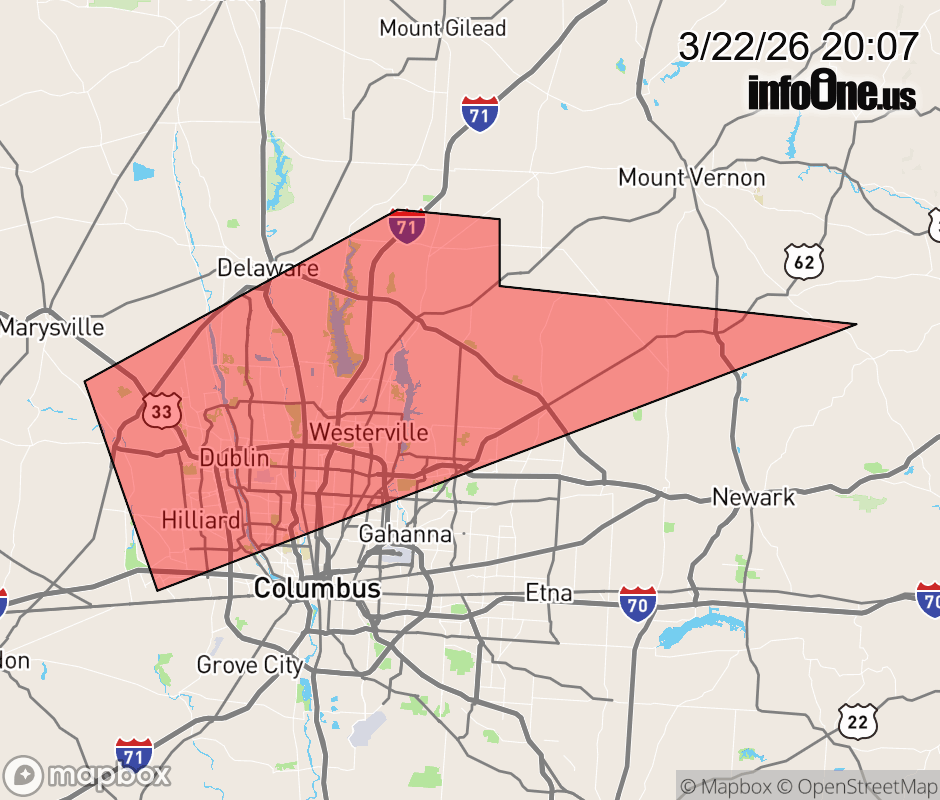 |
|||||||||
 Why aren't you using the InfoOne app? Why aren't you using the InfoOne app?
Stay abreast of information affecting your community! InfoOne tracks real-time information such as:
InfoOne currently supports over 100 communities in NC, VA and WV, and our coverage area is steadily growing. It's free! Install the InfoOne app today and see what you've been missing. |
|||||||||