|
|
Weather Alert |
| Kanawha County, WV | |||||||||
|
|
||||||||
|
Canceled 6/13/21 6:21 PM Severe Thunderstorm Warning issued June 13 at 5:57PM EDT until June 13 at 6:45PM EDT by NWS Charleston WV The National Weather Service in Charleston West Virginia has issued a * Severe Thunderstorm Warning for... Northern Kanawha County in central West Virginia... East central Putnam County in western West Virginia... * Until 645 PM EDT. * At 556 PM EDT, a severe thunderstorm was located over Sissonville, or 9 miles north of Charleston, moving southeast at 25 mph. HAZARD...60 mph wind gusts and quarter size hail. SOURCE...Radar indicated. IMPACT...Hail damage to vehicles is expected. Expect wind damage to roofs, siding, and trees. * Locations impacted include... Charleston, Nitro, Winfield, Jefferson, South Charleston, St. Albans, Dunbar, Sissonville, Chesapeake, Marmet, Belle, Poca, Cross Lanes, Pinch, Institute, Coal Fork, Elkview, Teays Valley and Bancroft. This includes the following highways... Interstate 79 between mile markers 1 and 15. Interstate 77 in West Virginia between mile markers 96 and 116. Interstate 64 in West Virginia between mile markers 43 and 57. West Virginia Turnpike between mile markers 88 and 95. Route 119 between mile markers 74 and 80. 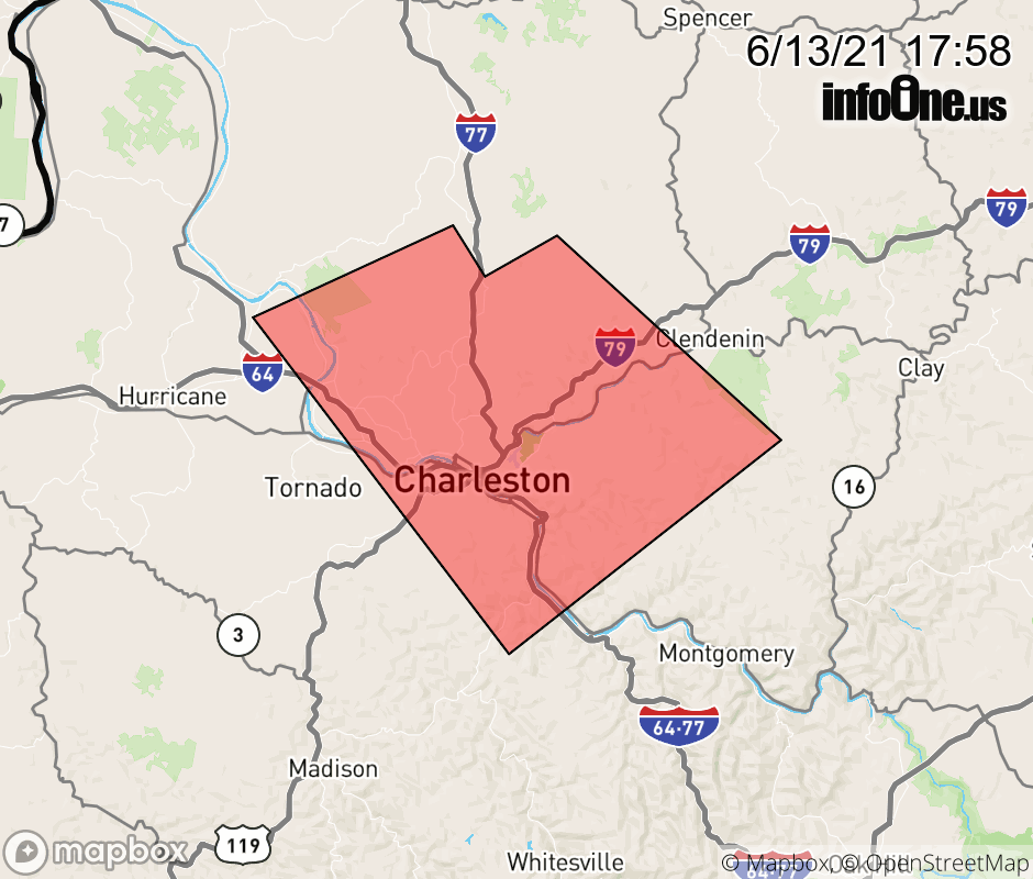 |
|||||||||
 Why aren't you using the InfoOne app? Why aren't you using the InfoOne app?
Stay abreast of information affecting your community! InfoOne tracks real-time information such as:
InfoOne currently supports over 100 communities in NC, VA and WV, and our coverage area is steadily growing. It's free! Install the InfoOne app today and see what you've been missing. |
|||||||||