|
|
Weather Alert |
| Kanawha County, WV | |||||||||
|
|
||||||||
|
Canceled 5/17/25 12:31 AM Severe Thunderstorm Warning issued May 17 at 12:13AM EDT until May 17 at 12:45AM EDT by NWS Charleston WV SVRRLX The National Weather Service in Charleston West Virginia has issued a * Severe Thunderstorm Warning for... West central Nicholas County in southeastern West Virginia... Kanawha County in central West Virginia... Northeastern Lincoln County in central West Virginia... Southwestern Clay County in north central West Virginia... Northwestern Fayette County in southeastern West Virginia... Boone County in central West Virginia... * Until 1245 AM EDT. * At 1212 AM EDT, severe thunderstorms were located along a line extending from near Alum Creek to near Madison, moving east at 65 mph. HAZARD...60 mph wind gusts and penny size hail. SOURCE...Radar indicated. IMPACT...Expect damage to roofs, siding, and trees. * Locations impacted include... Charleston, Madison, Fayetteville, Clay, Jefferson, South Charleston, St. Albans, Dunbar, Oak Hill, Montgomery, Chesapeake, Marmet, Ansted, Belle, Cedar Grove, East Bank, Glasgow, Smithers, Gauley Bridge, and Pratt. This includes the following highways... Interstate 79 between mile markers 1 and 6. Interstate 77 in West Virginia between mile markers 96 and 105. Interstate 64 in West Virginia between mile markers 51 and 57. West Virginia Turnpike between mile markers 61 and 95. Route 119 between mile markers 49 and 80. Route 19 between mile markers 13 and 25. 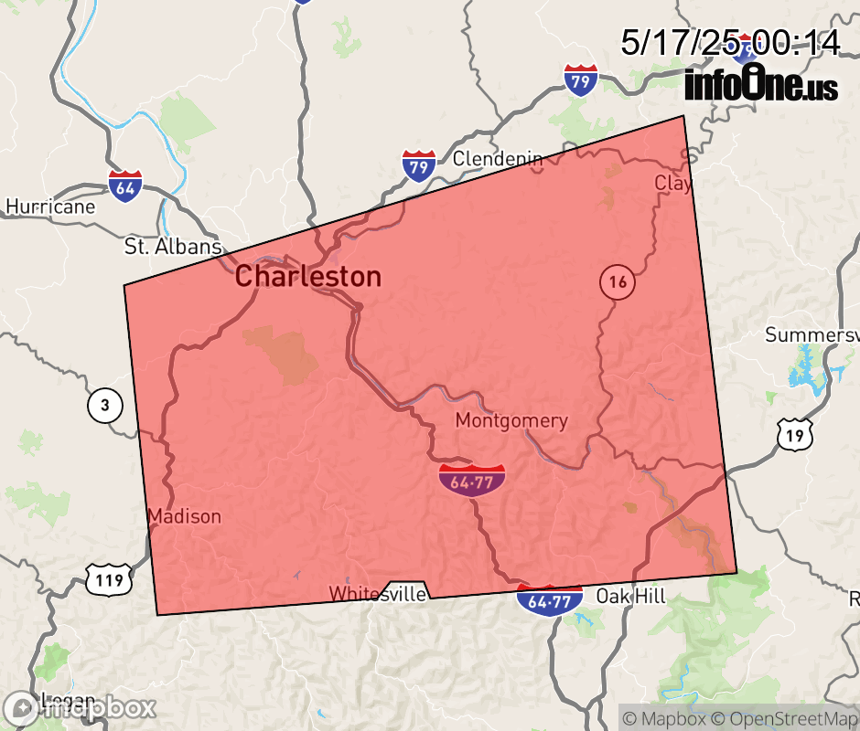 |
|||||||||
 Why aren't you using the InfoOne app? Why aren't you using the InfoOne app?
Stay abreast of information affecting your community! InfoOne tracks real-time information such as:
InfoOne currently supports over 100 communities in NC, VA and WV, and our coverage area is steadily growing. It's free! Install the InfoOne app today and see what you've been missing. |
|||||||||