|
|
Weather Alert |
| Franklin County, OH | |||||||||
|
|
||||||||
|
Canceled 3/22/26 5:31 PM Severe Thunderstorm Warning issued March 22 at 5:09PM EDT until March 22 at 6:00PM EDT by NWS Wilmington OH SVRILN The National Weather Service in Wilmington has issued a * Severe Thunderstorm Warning for... Northeastern Franklin County in central Ohio... Southeastern Delaware County in central Ohio... Southern Licking County in central Ohio... * Until 600 PM EDT. * At 508 PM EDT, a severe thunderstorm was located near Johnstown, moving east at 20 mph. HAZARD...60 mph wind gusts and half dollar size hail. SOURCE...Radar indicated. IMPACT...Minor hail damage to vehicles is possible. Expect wind damage to trees and power lines. * Locations impacted include... Columbus, Newark, Westerville, Heath, Granville, Pataskala, Johnstown, Hebron, Beechwood Trails, Granville South, New Albany, Jersey, Alexandria, State Route 310 at State Route 161, Center Village, and Huber Ridge. This includes I-70 in Ohio near mile marker 128. 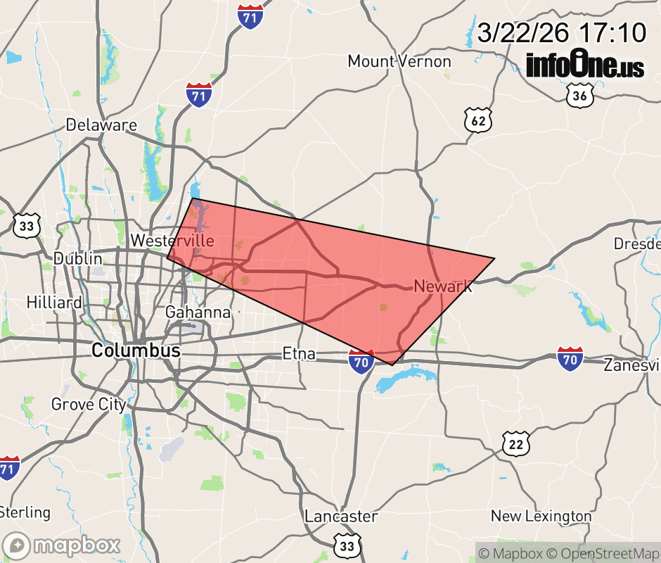 |
|||||||||
 Why aren't you using the InfoOne app? Why aren't you using the InfoOne app?
Stay abreast of information affecting your community! InfoOne tracks real-time information such as:
InfoOne currently supports over 100 communities in NC, VA and WV, and our coverage area is steadily growing. It's free! Install the InfoOne app today and see what you've been missing. |
|||||||||