|
|
Weather Alert |
| Franklin County, OH | |||||||||
|
|
||||||||
|
Canceled 3/22/26 10:38 PM Severe Thunderstorm Warning issued March 22 at 10:27PM EDT until March 22 at 11:15PM EDT by NWS Wilmington OH SVRILN The National Weather Service in Wilmington has issued a * Severe Thunderstorm Warning for... Southeastern Champaign County in west central Ohio... Southwestern Franklin County in central Ohio... Northwestern Pickaway County in central Ohio... Eastern Clark County in west central Ohio... South central Union County in central Ohio... Madison County in central Ohio... * Until 1115 PM EDT. * At 1027 PM EDT, a severe thunderstorm was located near Northridge, moving east at 50 mph. HAZARD...Quarter size hail. SOURCE...Radar indicated. IMPACT...Minor damage to vehicles is possible. * Locations impacted include... Columbus, Springfield, Grove City, Upper Arlington, Hilliard, Bexley, Urbana, London, Jefferson, Northridge, West Jefferson, Mount Sterling, South Charleston, Mechanicsburg, Choctaw Lake, Ohio State University, Lake Darby, Whitehall, Grandview Heights, and Obetz. This includes the following Interstates... I-70 in Ohio between mile markers 52 and 104. I-71 in Ohio between mile markers 81 and 111. 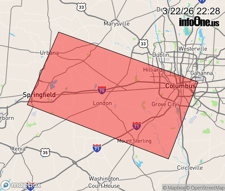 |
|||||||||
 Why aren't you using the InfoOne app? Why aren't you using the InfoOne app?
Stay abreast of information affecting your community! InfoOne tracks real-time information such as:
InfoOne currently supports over 100 communities in NC, VA and WV, and our coverage area is steadily growing. It's free! Install the InfoOne app today and see what you've been missing. |
|||||||||