|
|
Weather Alert |
| Summit County, OH | |||||||||
|
|
||||||||
|
Canceled 12/14/25 4:15 PM Special Weather Statement issued December 14 at 2:53PM EST by NWS Cleveland OH At 253 PM EST, radar indicated an intense lake effect snow band along a line extending from near Warrensville Heights to near West Farmington. This intense lake effect snow band was nearly stationary. HAZARDS INCLUDE... Winds to 30 mph... Visibility rapidly dropping to less than a quarter of a mile... Locations impacted include... Cleveland, Warren, Chardon, Parma, Solon, Hudson, Niles, Twinsburg, Streetsboro, Warrensville Heights, Macedonia, Hubbard, Cortland, South Russell, Middlefield, Garrettsville, North Bloomfield, Orwell, Burton, and Highland Hills. Use extra caution if you must travel into or through this lake effect snow band. Rapid changes in visibility and potentially slick roads are likely to lead to accidents. Consider delaying travel until this snow band passes your location. 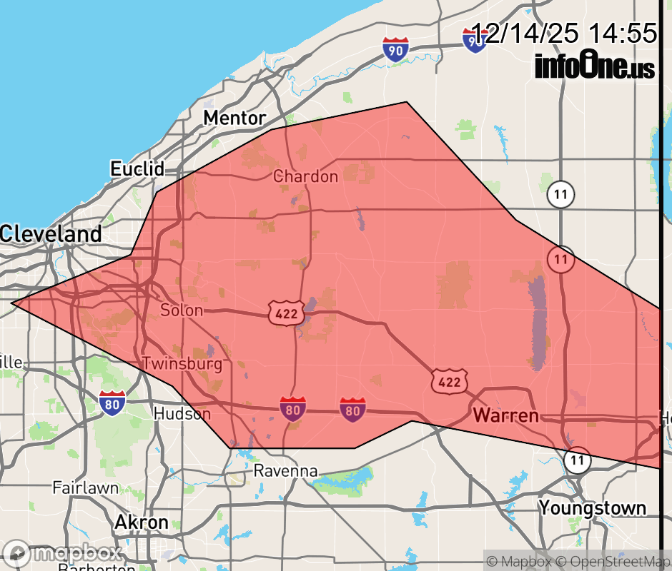 |
|||||||||
 Why aren't you using the InfoOne app? Why aren't you using the InfoOne app?
Stay abreast of information affecting your community! InfoOne tracks real-time information such as:
InfoOne currently supports over 100 communities in NC, VA and WV, and our coverage area is steadily growing. It's free! Install the InfoOne app today and see what you've been missing. |
|||||||||