|
|
Weather Alert |
| Mahoning County, OH | |||||||||
|
|
||||||||
|
Canceled 4/2/26 7:51 AM Flood Warning issued April 1 at 10:10PM EDT until April 2 at 11:45AM EDT by NWS Cleveland OH ...The Flood Warning is extended for the following rivers in Ohio... Portage River At Woodville affecting Sandusky and Wood Counties. Huron River Near Milan affecting Erie County. Cuyahoga River At Old Portage affecting Summit County. Blanchard River Near Findlay affecting Hancock County. Maumee River At Waterville affecting Lucas and Wood Counties. Killbuck Creek Near Killbuck affecting Holmes and Wayne Counties. ...The Flood Warning continues for the following rivers in Ohio... Sandusky River At Tiffin affecting Seneca County. Black River At Elyria affecting Lorain County. Mahoning River At Youngstown affecting Mahoning and Trumbull Counties. Eagle Creek Above Findlay affecting Hancock County. Eagle Creek At Phalanx Station affecting Trumbull County. For the Portage River...including Woodville...Minor flooding is forecast. For the Sandusky River...including Upper Sandusky, Fremont, Tiffin, Bucyrus...Minor flooding is forecast. For the Huron River...including Milan...Minor flooding is forecast. For the Black River...including Elyria...Minor flooding is forecast. For the Cuyahoga River...including Hiram Rapids, Jaite, Old Portage, Independence...Minor flooding is forecast. For the Blanchard River...including Findlay...Minor flooding is forecast. For the Maumee River...including Grand Rapids, Waterville...Minor flooding is forecast. For the Killbuck Creek...including Killbuck...Minor flooding is forecast. For the Mahoning River...including Leavittsburg, Warren, Youngstown...Minor flooding is forecast. For the Eagle Creek (Hancock)...including Findlay...Minor flooding is forecast. For the Eagle Creek (Trumbull)...including Phalanx Station...Minor flooding is forecast. * WHAT... Minor flooding is occurring and minor flooding is forecast. * WHERE... Mahoning River at Youngstown. * WHEN... Until late tomorrow morning. * IMPACTS... At 15.0 feet, Water inundates property on River and Front Streets in Girard. In Niles State Route 46 flooded and First Street begins to inundate. In Mahoning County flooding will spread into industrial areas along the river. * ADDITIONAL DETAILS... - At 9:15 PM EDT Wednesday the stage was 14.5 feet. - Forecast...The river is expected to rise to a crest of 15.0 feet just after midnight tonight. It will then fall below flood stage late tonight. - Flood stage is 14.0 feet. - Please visit www.weather.gov/safety/flood for flood safety and preparedness information. 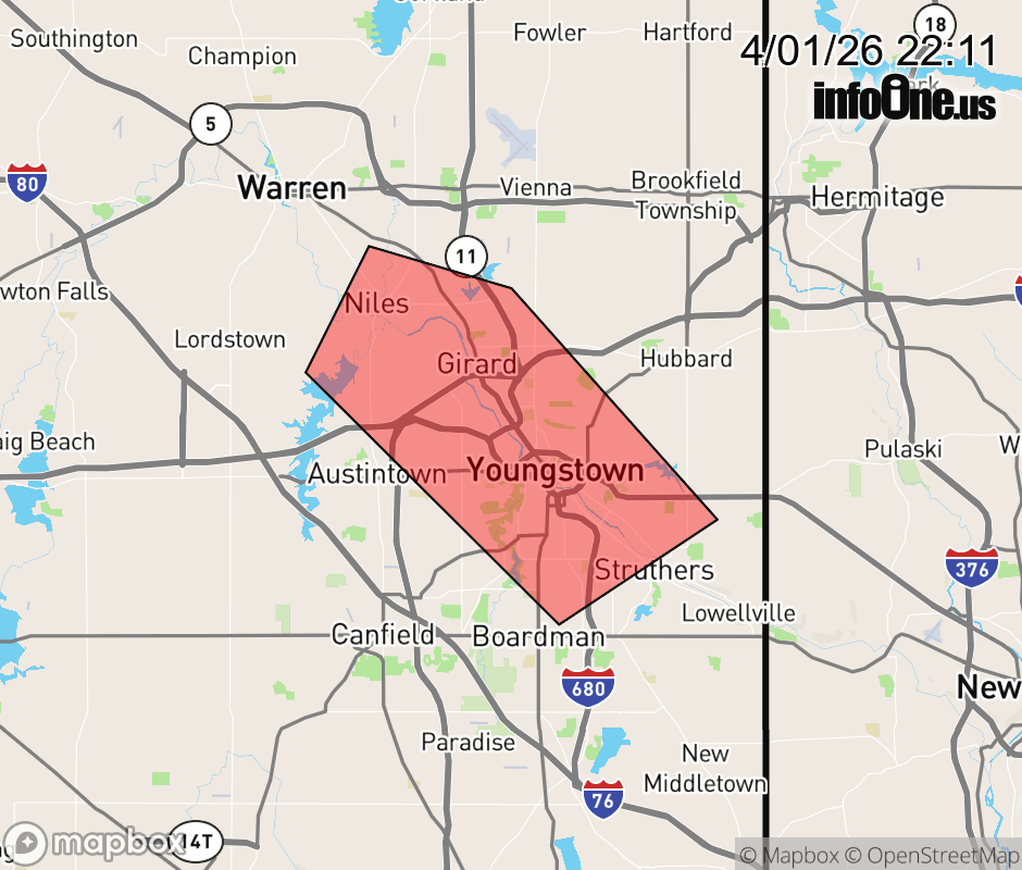 |
|||||||||
 Why aren't you using the InfoOne app? Why aren't you using the InfoOne app?
Stay abreast of information affecting your community! InfoOne tracks real-time information such as:
InfoOne currently supports over 100 communities in NC, VA and WV, and our coverage area is steadily growing. It's free! Install the InfoOne app today and see what you've been missing. |
|||||||||