|
|
Weather Alert |
| Augusta County, VA | |||||||||
|
|
||||||||
|
Canceled 2/3/25 8:57 PM Winter Storm Watch issued February 3 at 2:39PM EST until February 6 at 7:00AM EST by NWS Baltimore MD/Washington DC * WHAT... Heavy mixed precipitation possible. Ice accumulations up to three tenths of an inch possible. Total snow and sleet accumulations around half an inch, with localized amounts up to 1 inch possible. Winds could gust as high as 35 mph. * WHERE... Central Virginia Blue Ridge and Northern Virginia Blue Ridge. * WHEN... From Wednesday afternoon through Thursday morning. * IMPACTS... Roads, and especially bridges and overpasses, will likely become slick and hazardous. Power outages and tree damage are likely due to the ice. Travel could be nearly impossible. The hazardous conditions could impact the Wednesday evening and Thursday morning commutes. * ADDITIONAL DETAILS... Precipitation likely begins as sleet Wednesday morning, though it could mix with freezing rain at times. Sleet and freezing rain mix Wednesday afternoon, eventually becoming a steady freezing rain Wednesday evening into Wednesday night. A light freezing drizzle could continue Thursday morning before precipitation comes to an end. The highest ice accumulation is expected along the eastern facing slopes. 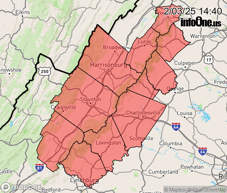 |
|||||||||
 Why aren't you using the InfoOne app? Why aren't you using the InfoOne app?
Stay abreast of information affecting your community! InfoOne tracks real-time information such as:
InfoOne currently supports over 100 communities in NC, VA and WV, and our coverage area is steadily growing. It's free! Install the InfoOne app today and see what you've been missing. |
|||||||||