|
|
Weather Alert |
| Lee County, VA | |||||||||
|
|
||||||||
|
Canceled 1/22/26 12:39 AM Winter Storm Watch issued January 21 at 12:27PM EST until January 25 at 7:00PM EST by NWS Morristown TN * WHAT... Heavy mixed precipitation possible. Total snow accumulations between 4 and 10 inches will be possible, primarily north of Knoxville with the heaviest accumulations near the Kentucky border and far western Virginia. In addition to the snow, ice accumulations up to one half of an inch will be possible, primarily south of Knoxville. The greatest ice accumulations will likely be south of a line from Crossville to Tellico Plains, especially the southern Cumberland Plateau. * WHERE... Portions of southwest North Carolina, east Tennessee, and southwest Virginia. * WHEN... From late Friday night through Sunday evening. * IMPACTS... Expect power outages and tree damage due to the ice. Travel could be impossible. * ADDITIONAL DETAILS... This is a complicated forecast and details regarding the location of heaviest snowfall and freezing rain totals remain uncertain. Significant changes could occur in the coming days so please continue to monitor future forecasts. 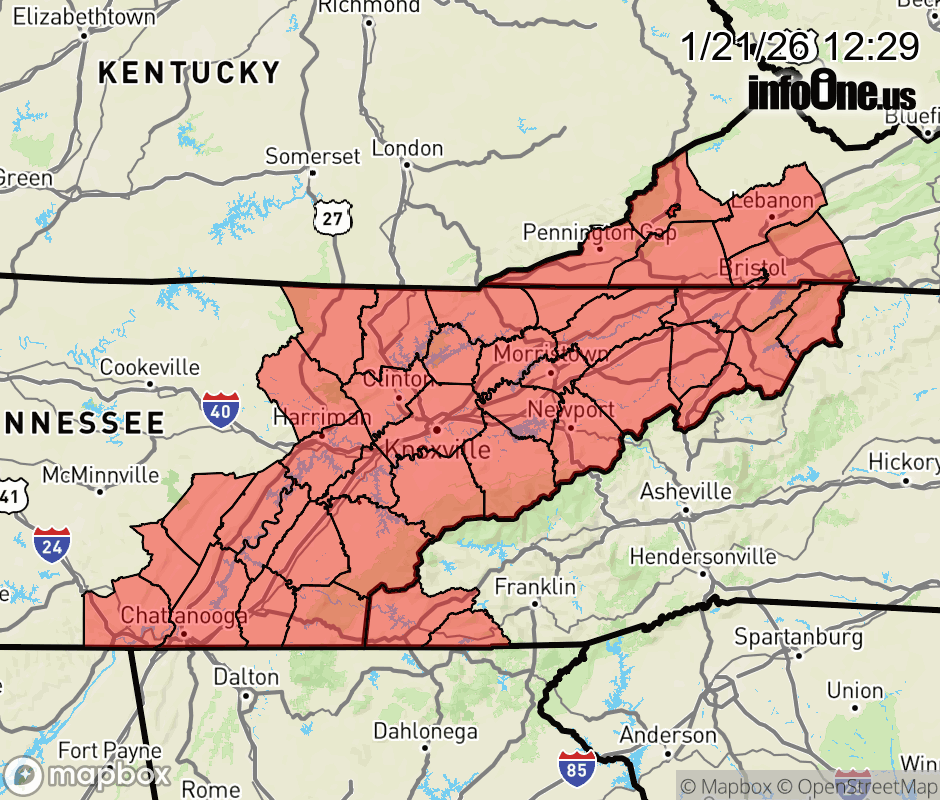 |
|||||||||
 Why aren't you using the InfoOne app? Why aren't you using the InfoOne app?
Stay abreast of information affecting your community! InfoOne tracks real-time information such as:
InfoOne currently supports over 100 communities in NC, VA and WV, and our coverage area is steadily growing. It's free! Install the InfoOne app today and see what you've been missing. |
|||||||||