|
|
Weather Alert |
| Durham County, NC | |||||||||
|
|
||||||||
|
Canceled 2/18/25 3:22 AM Winter Storm Watch issued February 17 at 3:14PM EST until February 20 at 10:00AM EST by NWS Raleigh NC * WHAT... Heavy mixed precipitation possible. Total snow and sleet accumulations between 1 and 6 inches, greatest accumulations towards the North Carolina and Virginia border. Ice accumulations up to two tenths of an inch possible, greatest accumulations along and south of US 64 corridor. * WHERE... Northern Piedmont and northern Coastal Plain. * WHEN... From Wednesday morning through Thursday morning. * IMPACTS... Plan on slippery road conditions. The hazardous conditions could impact the Wednesday morning and evening commutes, potentially impacting the Thursday morning commutes. * ADDITIONAL DETAILS... Expect predominantly a mixture of snow and sleet with a relatively short period of freezing rain. 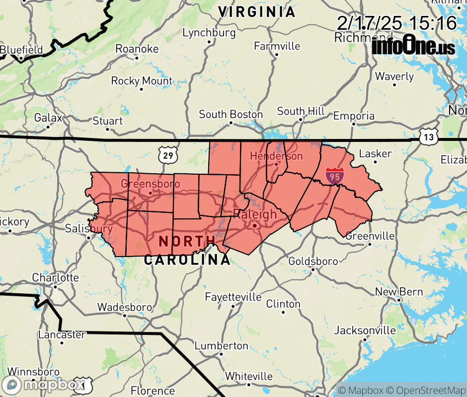 |
|||||||||
 Why aren't you using the InfoOne app? Why aren't you using the InfoOne app?
Stay abreast of information affecting your community! InfoOne tracks real-time information such as:
InfoOne currently supports over 100 communities in NC, VA and WV, and our coverage area is steadily growing. It's free! Install the InfoOne app today and see what you've been missing. |
|||||||||