|
|
Weather Alert |
| Mason County, WV | |||||||||
|
|
||||||||
|
Canceled 6/14/21 6:30 PM Special Weather Statement issued June 14 at 5:55PM EDT by NWS Charleston WV At 555 PM EDT, a strong thunderstorm was located near Albany, moving southeast at 40 mph. Winds in excess of 40 mph and pea size hail are possible with this storm. Locations impacted include... Pomeroy, Racine, Rutland, Forked Run State Park, New Haven, Mason, Middleport, Chester, Syracuse, Hartford City, Mount Alto, Reedsville, Dyesville, Darwin, Harrisonville, Dexter, Letart and Carpenter. Torrential rainfall is also occurring with this storm, and may cause localized flooding. Do not drive your vehicle through flooded roadways. Frequent cloud to ground lightning is occurring with this storm. Lightning can strike 10 miles away from a thunderstorm. Seek a safe shelter inside a building or vehicle. 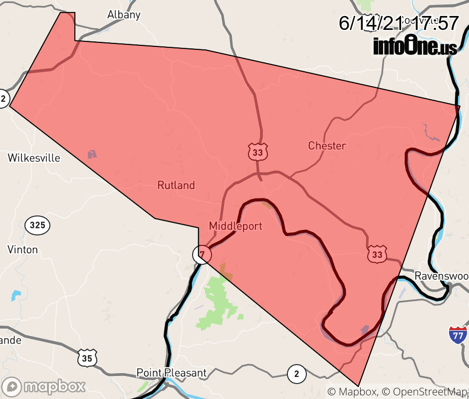 |
|||||||||
 Why aren't you using the InfoOne app? Why aren't you using the InfoOne app?
Stay abreast of information affecting your community! InfoOne tracks real-time information such as:
InfoOne currently supports over 100 communities in NC, VA and WV, and our coverage area is steadily growing. It's free! Install the InfoOne app today and see what you've been missing. |
|||||||||