|
|
Weather Alert |
| Raleigh County, WV | |||||||||
|
|
||||||||
|
Canceled 6/13/21 7:13 PM Severe Thunderstorm Warning issued June 13 at 6:49PM EDT until June 13 at 7:30PM EDT by NWS Charleston WV The National Weather Service in Charleston West Virginia has issued a * Severe Thunderstorm Warning for... Southwestern Pocahontas County in northeastern West Virginia... Nicholas County in southeastern West Virginia... East central Kanawha County in central West Virginia... Northeastern Raleigh County in southeastern West Virginia... Southern Webster County in northeastern West Virginia... Southern Clay County in north central West Virginia... Fayette County in southeastern West Virginia... * Until 730 PM EDT. * At 649 PM EDT, severe thunderstorms were located along a line extending from 11 miles northwest of Marlinton to near Richwood to near Smithers, moving south at 25 mph. HAZARD...60 mph wind gusts and quarter size hail. SOURCE...Radar indicated. IMPACT...Hail damage to vehicles is expected. Expect wind damage to roofs, siding, and trees. * Locations impacted include... Summersville, Fayetteville, Richwood, Marlinton, Babcock State Park, Webster Springs, Oak Hill, Mount Hope, Ansted, Addison (Webster Springs), Gauley Bridge, Camden-On-gauley, Bradley, Glen, Hawks Nest State Park, Craigsville, Camden On Gauley, Piney View, Prosperity and Powellton. This includes Route 19 between mile markers 1 and 54. 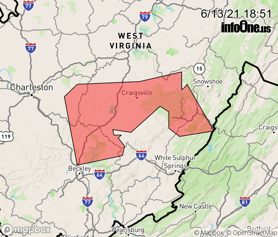 |
|||||||||
 Why aren't you using the InfoOne app? Why aren't you using the InfoOne app?
Stay abreast of information affecting your community! InfoOne tracks real-time information such as:
InfoOne currently supports over 100 communities in NC, VA and WV, and our coverage area is steadily growing. It's free! Install the InfoOne app today and see what you've been missing. |
|||||||||