|
|
Weather Alert |
| Lawrence County, OH | |||||||||
|
|
||||||||
|
Canceled 5/20/26 3:39 PM Severe Thunderstorm Warning issued May 20 at 3:20PM EDT until May 20 at 3:45PM EDT by NWS Charleston WV SVRRLX The National Weather Service in Charleston West Virginia has issued a * Severe Thunderstorm Warning for... Southeastern Lawrence County in southeastern Ohio... Southwestern Cabell County in central West Virginia... Northwestern Lincoln County in central West Virginia... Northern Wayne County in western West Virginia... * Until 345 PM EDT. * At 320 PM EDT, a severe thunderstorm was located over Centerville, or near Wayne, moving northeast at 20 mph. HAZARD...60 mph wind gusts and quarter size hail. SOURCE...Radar indicated. IMPACT...Hail damage to vehicles is expected. Expect wind damage to roofs, siding, and trees. * Locations impacted include... Huntington, Wayne, Chesapeake, Proctorville, Beech Fork State Park, Barboursville, Centerville, West Hamlin, Salt Rock, Pea Ridge, and Lavalette. This includes Interstate 64 in West Virginia between mile markers 6 and 20. 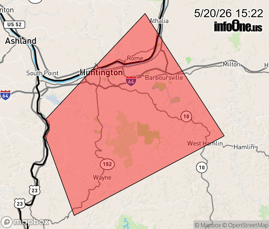 |
|||||||||
 Why aren't you using the InfoOne app? Why aren't you using the InfoOne app?
Stay abreast of information affecting your community! InfoOne tracks real-time information such as:
InfoOne currently supports over 100 communities in NC, VA and WV, and our coverage area is steadily growing. It's free! Install the InfoOne app today and see what you've been missing. |
|||||||||