|
|
Weather Alert |
| Radford, VA | |||||||||
|
|
||||||||
|
Canceled 2/15/25 8:00 PM Flood Watch issued February 15 at 3:36PM EST until February 16 at 7:00PM EST by NWS Blacksburg VA * WHAT... Flooding caused by excessive rainfall continues to be possible. * WHERE... Portions of northwest North Carolina, including the following areas, Alleghany NC, Ashe and Watauga, Virginia, including the following areas, Alleghany VA, Amherst, Bath, Bland, Botetourt, Carroll, Craig, Floyd, Giles, Grayson, Montgomery, Pulaski, Roanoke, Rockbridge, Smyth, Tazewell and Wythe, and southeast West Virginia, including the following areas, Eastern Greenbrier, Mercer, Monroe, Summers and Western Greenbrier. * WHEN... Through Sunday evening. * IMPACTS... Excessive runoff may result in flooding of rivers, creeks, streams, and other low-lying and flood-prone locations. Flooding may occur in poor drainage and urban areas. Storm drains and ditches may become clogged with debris. Area creeks and streams are running high and could flood with more heavy rain. * ADDITIONAL DETAILS... - Rain amounts of 1 to 2.5 inches have fallen with another 1 to 3 inches possible be Sunday evening. Locally higher rainfall amounts are possible across southeast West Virginia, the Alleghany Highlands, the southern Shenandoah Valley. Snowmelt may also contribute to runoff. - http://www.weather.gov/safety/flood 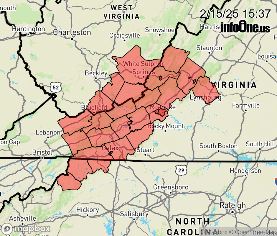 |
|||||||||
 Why aren't you using the InfoOne app? Why aren't you using the InfoOne app?
Stay abreast of information affecting your community! InfoOne tracks real-time information such as:
InfoOne currently supports over 100 communities in NC, VA and WV, and our coverage area is steadily growing. It's free! Install the InfoOne app today and see what you've been missing. |
|||||||||