|
|
Weather Alert |
| Meigs County, OH | |||||||||
|
|
||||||||
|
Canceled 7/9/25 12:15 PM Special Weather Statement issued July 9 at 11:39AM EDT by NWS Charleston WV At 1139 AM EDT, Doppler radar was tracking a strong thunderstorm 9 miles east of Albany, moving east at 25 mph. HAZARD...Wind gusts up to 40 mph and pea size hail. SOURCE...Radar indicated. IMPACT...Gusty winds could knock down tree limbs and blow around unsecured objects. Minor hail damage to vegetation is possible. Locations impacted include... Coolville, Tuppers Plains, Washington, Darwin, Belleville, Reedsville, and Little Hocking. 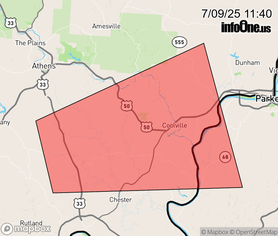 |
|||||||||
 Why aren't you using the InfoOne app? Why aren't you using the InfoOne app?
Stay abreast of information affecting your community! InfoOne tracks real-time information such as:
InfoOne currently supports over 100 communities in NC, VA and WV, and our coverage area is steadily growing. It's free! Install the InfoOne app today and see what you've been missing. |
|||||||||