|
|
Weather Alert |
| Watauga County, NC | |||||||||
|
|
||||||||
|
Canceled 5/12/25 10:32 PM Flood Warning issued May 12 at 7:22PM EDT until May 13 at 4:15AM EDT by NWS Blacksburg VA * WHAT... Small stream and river flooding caused by excessive rainfall is expected. * WHERE... A portion of northwest North Carolina, including the following county, Watauga. * WHEN... Until 415 AM EDT Tuesday. * IMPACTS... Flooding along the Watauga River and its tributaries is imminent or occurring. Low-water crossings are inundated with water and may not be passable, especially Shulls Mill Road near Foscoe, and Dewitt Barnett Road and Watauga River Road near Sugar Grove. * ADDITIONAL DETAILS... - At 719 PM EDT, Doppler radar and automated rain gauges indicated heavy rain. Flooding is already occurring in the warned area. Between 2 and 5 inches of rain have fallen. More rain is expected with 1 to 2 additional inches possible through midnight. - This includes the following streams and drainages... Laurel Creek, Laurel Fork, Beech Creek, Valley Creek, Grassy Gap Creek, Spice Bottom Creek, Dutch Creek, Watauga River, Brushy Fork, George Gap Branch, Beaverdam Creek, Pond Creek, Cove Creek and Craborchard Creek. - Some locations that will experience flooding include... Blowing Rock, Beech Mountain, Foscoe, Seven Devils, Valle Crucis, Rominger and Moses Cone Memorial Park. - http://www.weather.gov/safety/flood 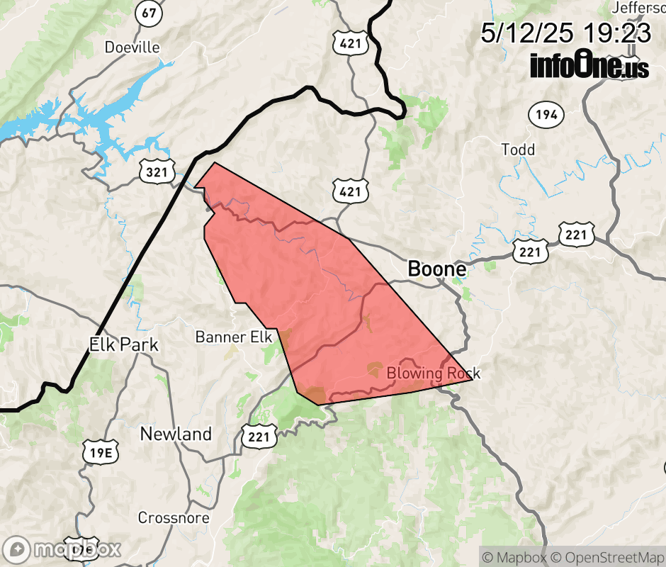 |
|||||||||
 Why aren't you using the InfoOne app? Why aren't you using the InfoOne app?
Stay abreast of information affecting your community! InfoOne tracks real-time information such as:
InfoOne currently supports over 100 communities in NC, VA and WV, and our coverage area is steadily growing. It's free! Install the InfoOne app today and see what you've been missing. |
|||||||||