|
|
Weather Alert |
| Calhoun County, WV | |||||||||
|
|
||||||||
|
Canceled 6/14/21 7:59 PM Severe Thunderstorm Warning issued June 14 at 7:34PM EDT until June 14 at 8:15PM EDT by NWS Charleston WV The National Weather Service in Charleston West Virginia has issued a * Severe Thunderstorm Warning for... Northeastern Calhoun County in north central West Virginia... Ritchie County in northwestern West Virginia... Gilmer County in north central West Virginia... West central Lewis County in northern West Virginia... North central Braxton County in north central West Virginia... * Until 815 PM EDT. * At 733 PM EDT, a severe thunderstorm was located near North Bend State Park, or near Harrisville, moving southeast at 50 mph. HAZARD...60 mph wind gusts and quarter size hail. SOURCE...Radar indicated. IMPACT...Hail damage to vehicles is expected. Expect wind damage to roofs, siding, and trees. * Locations impacted include... Harrisville, Glenville, North Bend State Park, Cedar Creek State Park, Burnsville, Ellenboro, Cairo, Sand Fork, Pullman, Auburn, Smithville, Newberne, Alum Bridge, Big Springs, Berea, Tanner, Burnt House, Baldwin, Nutter Farm and Stouts Mills. This includes the following highways... Interstate 79 between mile markers 76 and 85. Route 50 in West Virginia between mile markers 26 and 37. 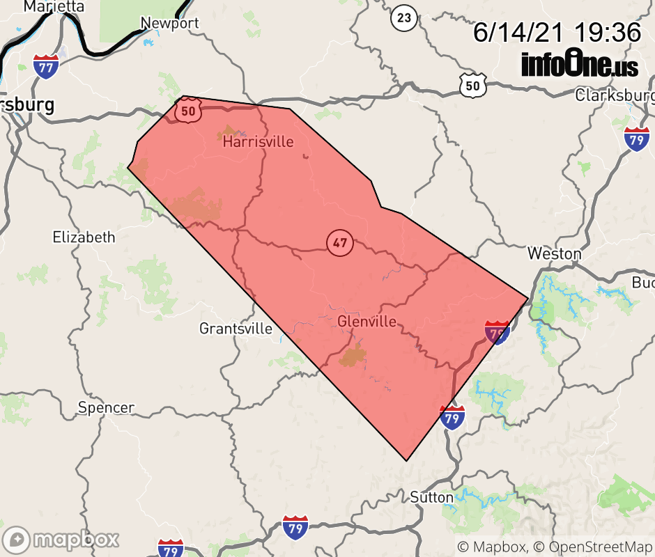 |
|||||||||
 Why aren't you using the InfoOne app? Why aren't you using the InfoOne app?
Stay abreast of information affecting your community! InfoOne tracks real-time information such as:
InfoOne currently supports over 100 communities in NC, VA and WV, and our coverage area is steadily growing. It's free! Install the InfoOne app today and see what you've been missing. |
|||||||||