|
|
Weather Alert |
| McDowell County, WV | |||||||||
|
|
||||||||
|
Canceled 6/9/21 4:45 PM Special Weather Statement issued June 9 at 3:57PM EDT by NWS Charleston WV At 357 PM EDT, a strong thunderstorm was located over Gary, or near Welch, moving east at 15 mph. Locations impacted include... Gary, Northfork, Keystone, Anawalt, Kimball and Elbert. Torrential rainfall is also occurring with this storm, and may cause localized flooding. Do not drive your vehicle through flooded roadways. Frequent cloud to ground lightning is occurring with this storm. Lightning can strike 10 miles away from a thunderstorm. Seek a safe shelter inside a building or vehicle. In hilly terrain there are hundreds of low water crossings which are potentially dangerous in heavy rain. Do not attempt to travel across flooded roads. Find alternate routes. It takes only a few inches of swiftly flowing water to carry vehicles away. Do not drive your vehicle into areas where the water covers the roadway. The water depth may be too great to allow your car to cross safely. Move to higher ground. 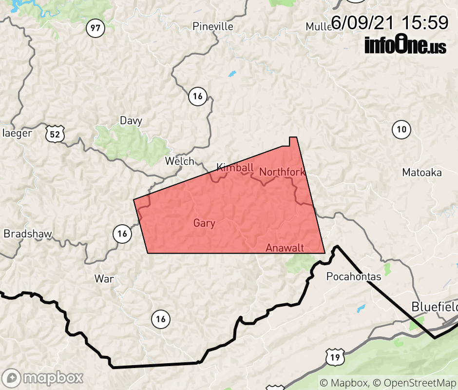 |
|||||||||
 Why aren't you using the InfoOne app? Why aren't you using the InfoOne app?
Stay abreast of information affecting your community! InfoOne tracks real-time information such as:
InfoOne currently supports over 100 communities in NC, VA and WV, and our coverage area is steadily growing. It's free! Install the InfoOne app today and see what you've been missing. |
|||||||||