|
|
Weather Alert |
| Orange County, NC | |||||||||
|
|
||||||||
|
Canceled 12/19/25 6:44 AM Severe Thunderstorm Warning issued December 19 at 6:21AM EST until December 19 at 7:00AM EST by NWS Raleigh NC SVRRAH The National Weather Service in Raleigh has issued a * Severe Thunderstorm Warning for... Southeastern Person County in central North Carolina... Vance County in central North Carolina... Western Warren County in central North Carolina... Eastern Orange County in central North Carolina... Granville County in central North Carolina... Northern Lee County in central North Carolina... Wake County in central North Carolina... Durham County in central North Carolina... Chatham County in central North Carolina... Northwestern Franklin County in central North Carolina... * Until 700 AM EST. * At 621 AM EST, severe thunderstorms were located along a line extending from near Virgilina to near Rougemont to near Chapel Hill to 6 miles southwest of Pittsboro to near Goldston, moving east at 60 mph. HAZARD...60 mph wind gusts. SOURCE...Radar indicated. IMPACT...Expect damage to roofs, siding, and trees. * Locations impacted include... Raleigh, Durham, Cary, Chapel Hill, Sanford, Henderson, Oxford, Hillsborough, Creedmoor, and Pittsboro. This includes the following highways... Interstate 85 between Mile Markers 165 and 233. Interstate 40 between Mile Markers 261 and 301. Interstate 440 between Mile Markers 1 and 16. Interstate 540 between Mile Markers 0 and 21. US 1 between Mile Markers 69 and 101. the Durham Freeway between Mile Markers 2 and 17. 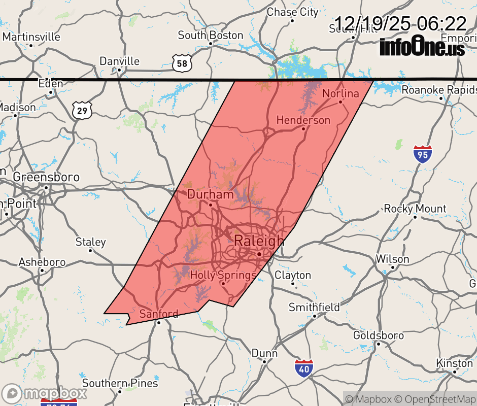 |
|||||||||
 Why aren't you using the InfoOne app? Why aren't you using the InfoOne app?
Stay abreast of information affecting your community! InfoOne tracks real-time information such as:
InfoOne currently supports over 100 communities in NC, VA and WV, and our coverage area is steadily growing. It's free! Install the InfoOne app today and see what you've been missing. |
|||||||||