|
|
Weather Alert |
| Lewis County, WV | |||||||||
|
|
||||||||
|
Canceled 5/13/25 3:45 PM Special Weather Statement issued May 13 at 3:29PM EDT by NWS Charleston WV At 328 PM EDT, Doppler radar was tracking a cluster of strong thunderstorms 7 miles northwest of Rock Cave, or 10 miles south of Weston, moving north at 20 mph. HAZARD...Pea size hail. SOURCE...Radar indicated. IMPACT...Minor hail damage to vegetation is possible. Locations impacted include... Weston, Stonewall Jackson, Rock Cave, Camden, Alexander, Eden, Sand Run, Cleveland, Walkersville, Alum Bridge, Kanawha Head, Ireland, Horner, and French Creek. This includes the following highways... Interstate 79 between mile markers 84 and 104. Route 33 between mile markers 1 and 6. 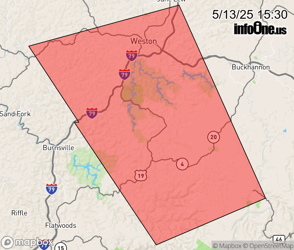 |
|||||||||
 Why aren't you using the InfoOne app? Why aren't you using the InfoOne app?
Stay abreast of information affecting your community! InfoOne tracks real-time information such as:
InfoOne currently supports over 100 communities in NC, VA and WV, and our coverage area is steadily growing. It's free! Install the InfoOne app today and see what you've been missing. |
|||||||||