|
|
Weather Alert |
| Clay County, WV | |||||||||
|
|
||||||||
|
Canceled 2/10/26 8:15 PM Special Weather Statement issued February 10 at 7:43PM EST by NWS Charleston WV At 742 PM EST, Doppler radar was tracking a strong thunderstorm over Charleston, moving east at 50 mph. HAZARD...Half inch hail. SOURCE...Radar indicated. IMPACT...Minor hail damage to vegetation is possible. Locations impacted include... Charleston, Clay, South Charleston, Dunbar, Clendenin, Pinch, Glen, Coal Fork, Elkview, Bickmore, Procious, Indore, Pond Gap, and Bentree. This includes the following highways... Interstate 79 between mile markers 1 and 14. Interstate 77 in West Virginia between mile markers 96 and 109. Interstate 64 in West Virginia between mile markers 54 and 57. West Virginia Turnpike between mile markers 92 and 95. Route 119 between mile markers 76 and 80. 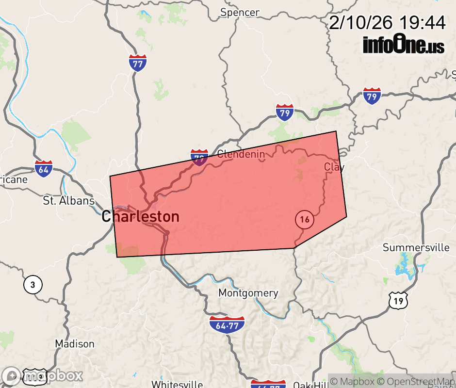 |
|||||||||
 Why aren't you using the InfoOne app? Why aren't you using the InfoOne app?
Stay abreast of information affecting your community! InfoOne tracks real-time information such as:
InfoOne currently supports over 100 communities in NC, VA and WV, and our coverage area is steadily growing. It's free! Install the InfoOne app today and see what you've been missing. |
|||||||||