|
|
Weather Alert |
| Anson County, NC | |||||||||
|
|
||||||||
|
Canceled 3/16/25 7:30 PM Severe Thunderstorm Warning issued March 16 at 7:12PM EDT until March 16 at 7:30PM EDT by NWS Raleigh NC At 711 PM EDT, a severe thunderstorm was located 9 miles south of Biscoe, or 11 miles southeast of Troy, moving northeast at 50 mph. HAZARD...60 mph wind gusts and penny size hail. SOURCE...Radar indicated. IMPACT...Expect damage to roofs, siding, and trees. Locations impacted include... Biscoe, Star, Mount Gilead, Candor, Eagle Springs, Covington, Pekin, Wadesboro, Troy, and Blewett Falls Lake. 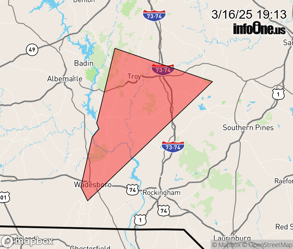 |
|||||||||
 Why aren't you using the InfoOne app? Why aren't you using the InfoOne app?
Stay abreast of information affecting your community! InfoOne tracks real-time information such as:
InfoOne currently supports over 100 communities in NC, VA and WV, and our coverage area is steadily growing. It's free! Install the InfoOne app today and see what you've been missing. |
|||||||||