|
|
Weather Alert |
| Cabell County, WV | |||||||||
|
|
||||||||
|
Canceled 6/13/25 8:02 PM Severe Thunderstorm Warning issued June 13 at 7:46PM EDT until June 13 at 8:30PM EDT by NWS Charleston WV SVRRLX The National Weather Service in Charleston West Virginia has issued a * Severe Thunderstorm Warning for... Southeastern Boyd County in northeastern Kentucky... Northeastern Lawrence County in northeastern Kentucky... South central Lawrence County in southeastern Ohio... Southwestern Cabell County in central West Virginia... Northwestern Lincoln County in central West Virginia... Northern Wayne County in western West Virginia... * Until 830 PM EDT. * At 745 PM EDT, a severe thunderstorm was located over Centerville, or near Wayne, moving northeast at 25 mph. HAZARD...60 mph wind gusts. SOURCE...Radar indicated. IMPACT...Expect damage to roofs, siding, and trees. * Locations impacted include... Huntington, Louisa, Wayne, Hamlin, Chesapeake, Proctorville, Beech Fork State Park, Yatesville Lake State Park, Barboursville, Fort Gay, Durbin, East Lynn Lake, Burnaugh, Centerville, West Hamlin, Lockwood, Lavalette, Branchland, Buchanan, and Salt Rock. This includes Interstate 64 in West Virginia between mile markers 5 and 16. 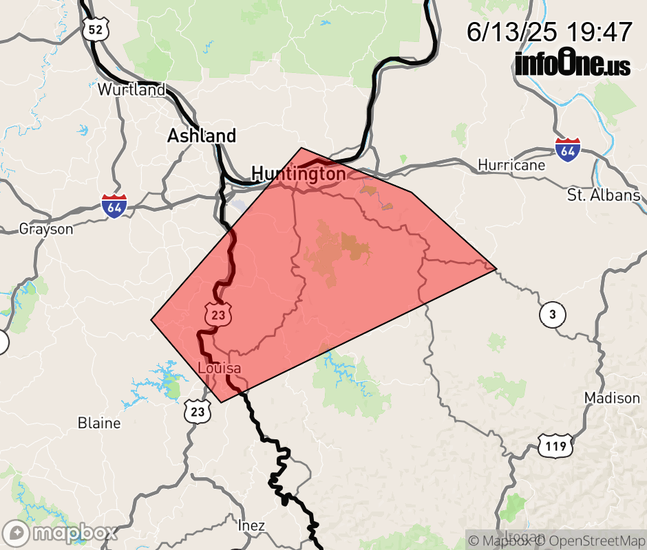 |
|||||||||
 Why aren't you using the InfoOne app? Why aren't you using the InfoOne app?
Stay abreast of information affecting your community! InfoOne tracks real-time information such as:
InfoOne currently supports over 100 communities in NC, VA and WV, and our coverage area is steadily growing. It's free! Install the InfoOne app today and see what you've been missing. |
|||||||||