|
|
Weather Alert |
| Boone County, WV | |||||||||
|
|
||||||||
|
Canceled 3/16/25 10:45 AM Severe Thunderstorm Warning issued March 16 at 10:19AM EDT until March 16 at 11:00AM EDT by NWS Charleston WV SVRRLX The National Weather Service in Charleston West Virginia has issued a * Severe Thunderstorm Warning for... Central Mingo County in southern West Virginia... Logan County in southern West Virginia... Central Boone County in central West Virginia... * Until 1100 AM EDT. * At 1018 AM EDT, a severe thunderstorm was located over Chattaroy, or over Williamson, moving northeast at 50 mph. HAZARD...60 mph wind gusts and quarter size hail. SOURCE...Radar indicated. IMPACT...Hail damage to vehicles is expected. Expect wind damage to roofs, siding, and trees. * Locations impacted include... Mount Gay, Chapmanville, Madison, Van, Chauncey, Turtle Creek, Myrtle, Matewan, Mount Gay-Shamrock, Williamson, Mitchell Heights, Sharples, Sarah Ann, Bald Knob, Jeffrey, Chief Logan State, Verdunville, Holden, Delbarton, and Amherstdale-Robinette. This includes Route 119 between mile markers 1 and 53. 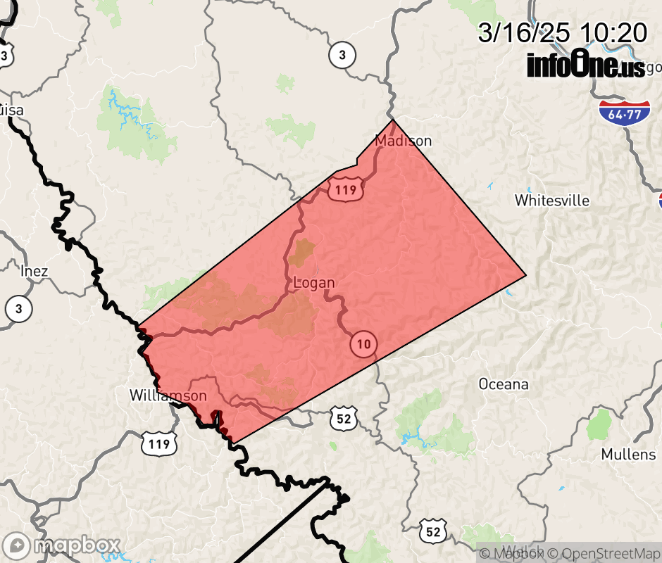 |
|||||||||
 Why aren't you using the InfoOne app? Why aren't you using the InfoOne app?
Stay abreast of information affecting your community! InfoOne tracks real-time information such as:
InfoOne currently supports over 100 communities in NC, VA and WV, and our coverage area is steadily growing. It's free! Install the InfoOne app today and see what you've been missing. |
|||||||||