|
|
Weather Alert |
| Montgomery County, VA | |||||||||
|
|
||||||||
|
Canceled 5/29/23 5:02 PM Flood Warning issued May 29 at 12:49PM EDT until May 29 at 6:45PM EDT by NWS Blacksburg VA * WHAT... Flooding of the South Fork of the Roanoke River caused by excessive rainfall is expected. * WHERE... Portions of southwest Virginia and west central Virginia, including the following counties, in southwest Virginia, Montgomery. In west central Virginia, Roanoke. * WHEN... Until 645 PM EDT Monday. * IMPACTS... Flooding of rivers, creeks, streams, and other low-lying and flood-prone locations is imminent or occurring. * ADDITIONAL DETAILS... - At 1244 PM EDT, Doppler radar and automated rain gauges indicate heavy rain fell earlier today across eastern Floyd County into eastern Montgomery County. Minor flooding is expected along the South Fork of the Roanoke River, as well as along tributaries that feed into the river. - This includes the following streams and drainages... Roanoke River, Georges Run, Brake Branch, Eckels Branch, Bonys Run, Dry Branch, Flatwoods Branch, Big Bear Rock Branch, Calhoun Run, North Fork Roanoke River, Elliott Creek, Brush Creek and Lick Fork. - Some locations that will experience flooding include... Christiansburg, Shawsville, Elliston-Lafayette, Crockett Springs, Glenvar and Elliston. - For flooding safety information, please visit http://www.weather.gov/safety/flood 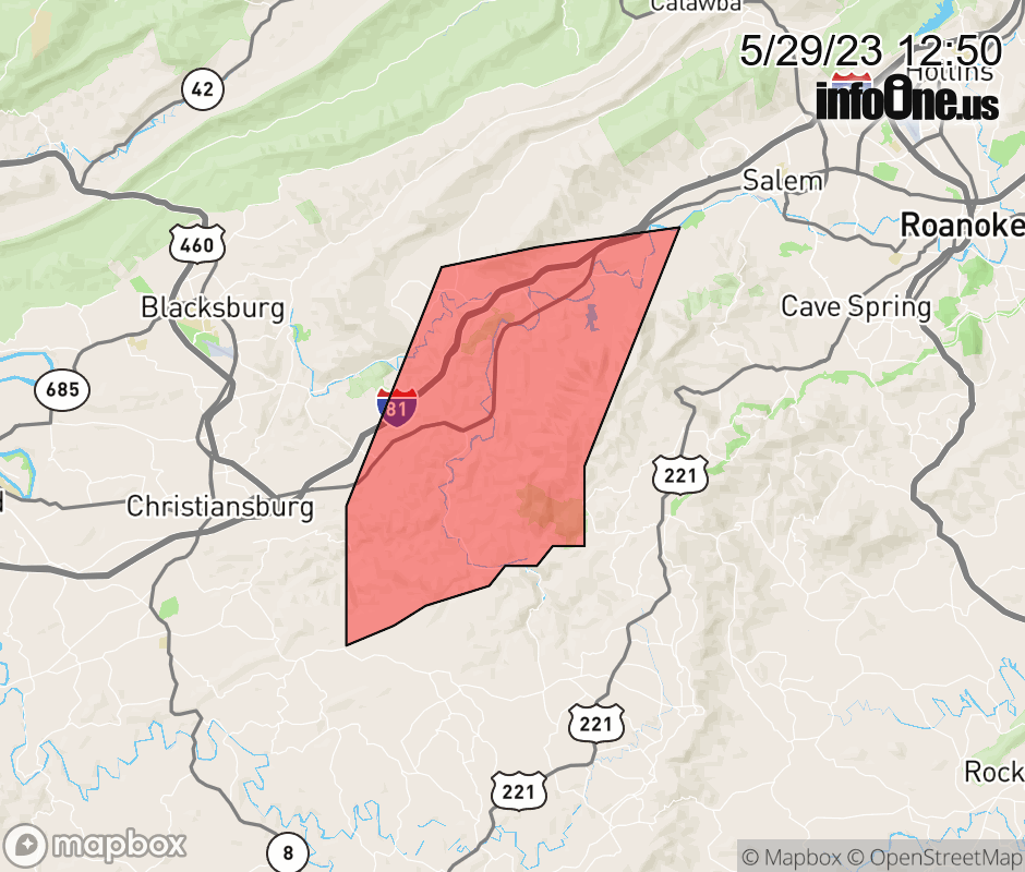 |
|||||||||
 Why aren't you using the InfoOne app? Why aren't you using the InfoOne app?
Stay abreast of information affecting your community! InfoOne tracks real-time information such as:
InfoOne currently supports over 100 communities in NC, VA and WV, and our coverage area is steadily growing. It's free! Install the InfoOne app today and see what you've been missing. |
|||||||||