|
|
Weather Alert |
| Washington County, VA | |||||||||
|
|
||||||||
|
Canceled 3/16/25 11:15 PM Special Weather Statement issued March 16 at 10:25PM EDT by NWS Morristown TN At 1024 PM EDT, Doppler radar was tracking a strong thunderstorm over Central, or near Elizabethton, moving northeast at 35 mph. HAZARD...Wind gusts up to 40 mph and penny size hail. SOURCE...Radar indicated. IMPACT...Gusty winds could knock down tree limbs and blow around unsecured objects. Minor hail damage to vegetation is possible. Locations impacted include... Hunter, Morril's Cave, Bluff City, Laurel Bloomery, Elizabethton, Central, Watauga, Sadie, Shady Valley, and South Holston Dam. 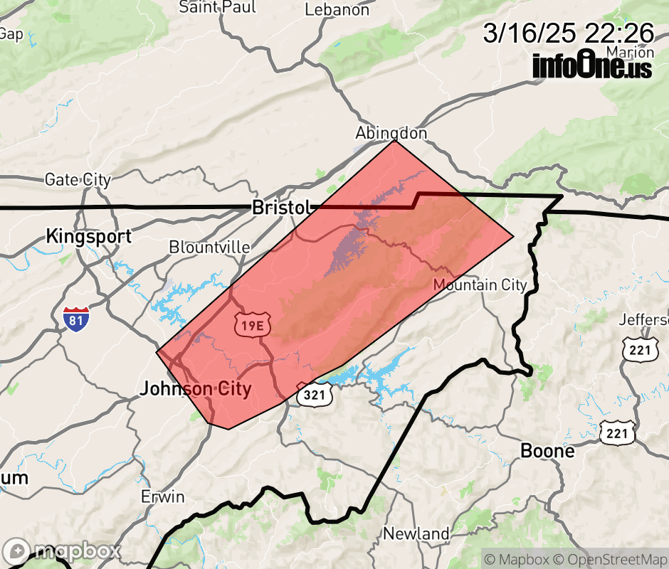 |
|||||||||
 Why aren't you using the InfoOne app? Why aren't you using the InfoOne app?
Stay abreast of information affecting your community! InfoOne tracks real-time information such as:
InfoOne currently supports over 100 communities in NC, VA and WV, and our coverage area is steadily growing. It's free! Install the InfoOne app today and see what you've been missing. |
|||||||||