|
|
Weather Alert |
| Moore County, NC | |||||||||
|
|
||||||||
|
Canceled 3/5/25 10:24 AM Severe Thunderstorm Warning issued March 5 at 10:05AM EST until March 5 at 10:45AM EST by NWS Raleigh NC SVRRAH The National Weather Service in Raleigh has issued a * Severe Thunderstorm Warning for... Moore County in central North Carolina... Southeastern Montgomery County in central North Carolina... Southeastern Randolph County in central North Carolina... Western Lee County in central North Carolina... Chatham County in central North Carolina... * Until 1045 AM EST. * At 1004 AM EST, severe thunderstorms were located along a line extending from 9 miles northwest of Siler City to 11 miles south of Biscoe, moving northeast at 45 mph. HAZARD...60 mph wind gusts and penny size hail. SOURCE...Radar indicated. IMPACT...Expect damage to roofs, siding, and trees. * Locations impacted include... Pittsboro, Vass, Siler City, Harpers Crossroads, Goldston, Cameron, Foxfire, Robbins, Carthage and Southern Pines. 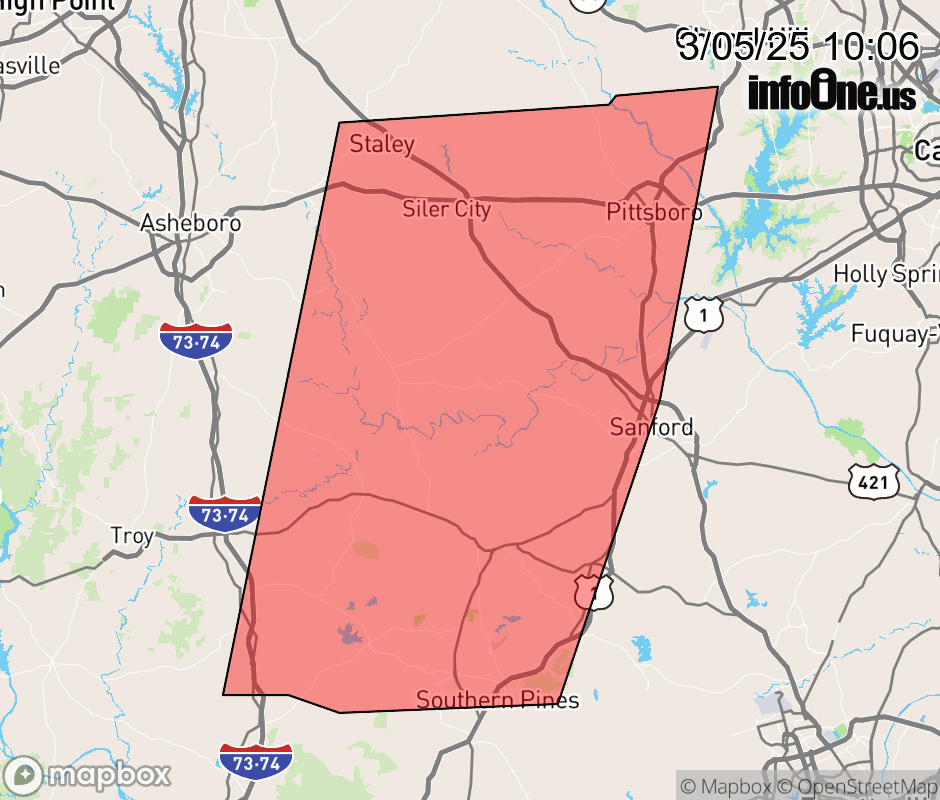 |
|||||||||
 Why aren't you using the InfoOne app? Why aren't you using the InfoOne app?
Stay abreast of information affecting your community! InfoOne tracks real-time information such as:
InfoOne currently supports over 100 communities in NC, VA and WV, and our coverage area is steadily growing. It's free! Install the InfoOne app today and see what you've been missing. |
|||||||||