|
|
Weather Alert |
| Clay County, WV | |||||||||
|
|
||||||||
|
Canceled 11/16/25 12:36 AM Severe Thunderstorm Warning issued November 16 at 12:21AM EST until November 16 at 12:45AM EST by NWS Charleston WV SVRRLX The National Weather Service in Charleston West Virginia has issued a * Severe Thunderstorm Warning for... West central Nicholas County in southeastern West Virginia... East central Kanawha County in central West Virginia... Southwestern Clay County in north central West Virginia... Northwestern Fayette County in southeastern West Virginia... * Until 1245 AM EST. * At 1220 AM EST, a severe thunderstorm was located near Pinch, or 12 miles east of Charleston, moving southeast at 40 mph. HAZARD...60 mph wind gusts. SOURCE...Radar indicated. IMPACT...Expect damage to roofs, siding, and trees. * Locations impacted include... Charleston, Montgomery, Ansted, Cedar Grove, East Bank, Glasgow, Smithers, Gauley Bridge, Pratt, Powellton, Glen, Hawks Nest State Park, Coal Fork, Handley, Swiss, Indore, Bentree, Drennan, and Pond Gap. This includes the following highways... Interstate 77 in West Virginia near mile marker 96. West Virginia Turnpike near mile marker 95. 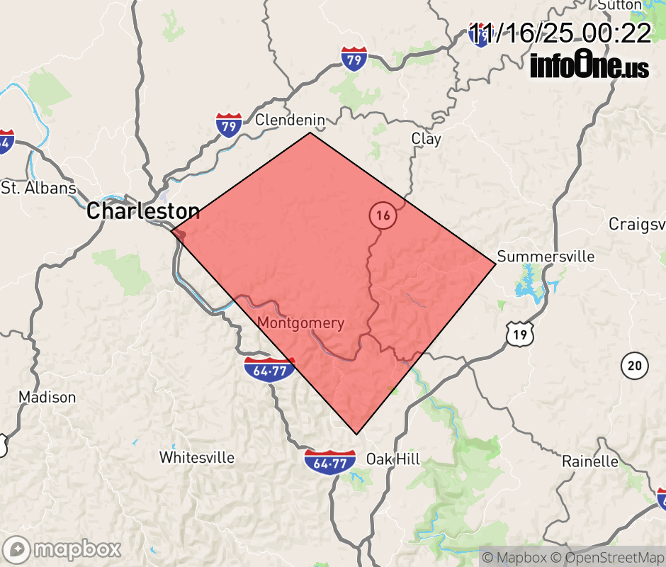 |
|||||||||
 Why aren't you using the InfoOne app? Why aren't you using the InfoOne app?
Stay abreast of information affecting your community! InfoOne tracks real-time information such as:
InfoOne currently supports over 100 communities in NC, VA and WV, and our coverage area is steadily growing. It's free! Install the InfoOne app today and see what you've been missing. |
|||||||||