|
|
Weather Alert |
| Boone County, WV | |||||||||
|
|
||||||||
|
Canceled 7/8/25 8:22 PM Flash Flood Warning issued July 8 at 6:44PM EDT until July 8 at 8:30PM EDT by NWS Charleston WV At 644 PM EDT, Doppler radar indicated previous thunderstorms produced between 2 and 4 inches of rain. Flooding impacts will continue, but no additional rainfall is expected. Flash flooding is ongoing or expected to begin shortly. HAZARD...Flash flooding caused by thunderstorms. SOURCE...Radar. IMPACT...Flash flooding of small creeks and streams, urban areas, highways, streets and underpasses as well as other poor drainage and low-lying areas. Some locations that will experience flash flooding include... Madison, Logan, Chief Logan State, Van, Mount Gay-Shamrock, Holden, Danville, West Logan, Mitchell Heights, Sharples, Jeffrey, Blair, Turtle Creek, Mount Gay and Verdunville. 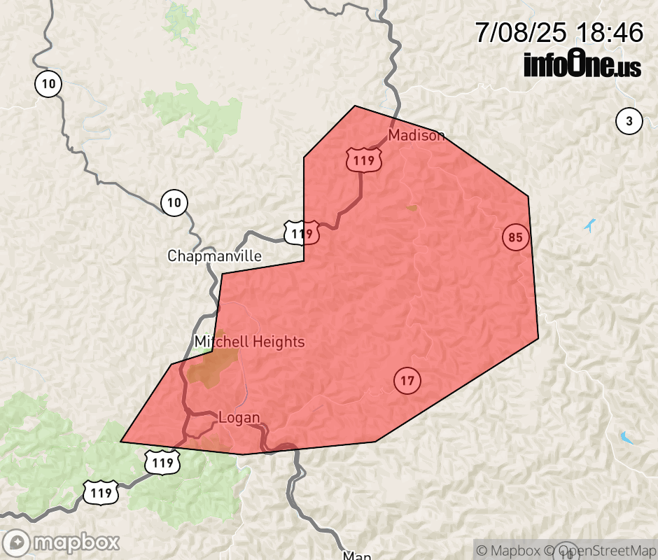 |
|||||||||
 Why aren't you using the InfoOne app? Why aren't you using the InfoOne app?
Stay abreast of information affecting your community! InfoOne tracks real-time information such as:
InfoOne currently supports over 100 communities in NC, VA and WV, and our coverage area is steadily growing. It's free! Install the InfoOne app today and see what you've been missing. |
|||||||||