|
|
Weather Alert |
| Montgomery County, NC | |||||||||
|
|
||||||||
|
Canceled 10/19/25 11:00 PM Special Weather Statement issued October 19 at 9:53PM EDT by NWS Raleigh NC At 953 PM EDT, Doppler radar was tracking gusty showers along a line extending from 7 miles southwest of South Hill to 7 miles west of Cary to near Sturdivants. Movement was east at 40 mph. HAZARD...Wind gusts up to 50 mph. SOURCE...Radar indicated. IMPACT...Gusty winds could knock down tree limbs and blow around unsecured objects. Locations impacted include... Raleigh, Durham, Cary, Sanford, Roanoke Rapids, Henderson, Southern Pines, Rockingham, Oxford, and Wadesboro. This includes the following highways... Interstate 85 between Mile Markers 178 and 233. Interstate 40 between Mile Markers 274 and 320. Interstate 440 between Mile Markers 1 and 16. Interstate 540 between Mile Markers 0 and 24. US 1 between Mile Markers 69 and 101. NC Highway 264 between Mile Markers 20 and 29. the Durham Freeway between Mile Markers 2 and 11. Interstate 73 between Mile Markers 26 and 47. 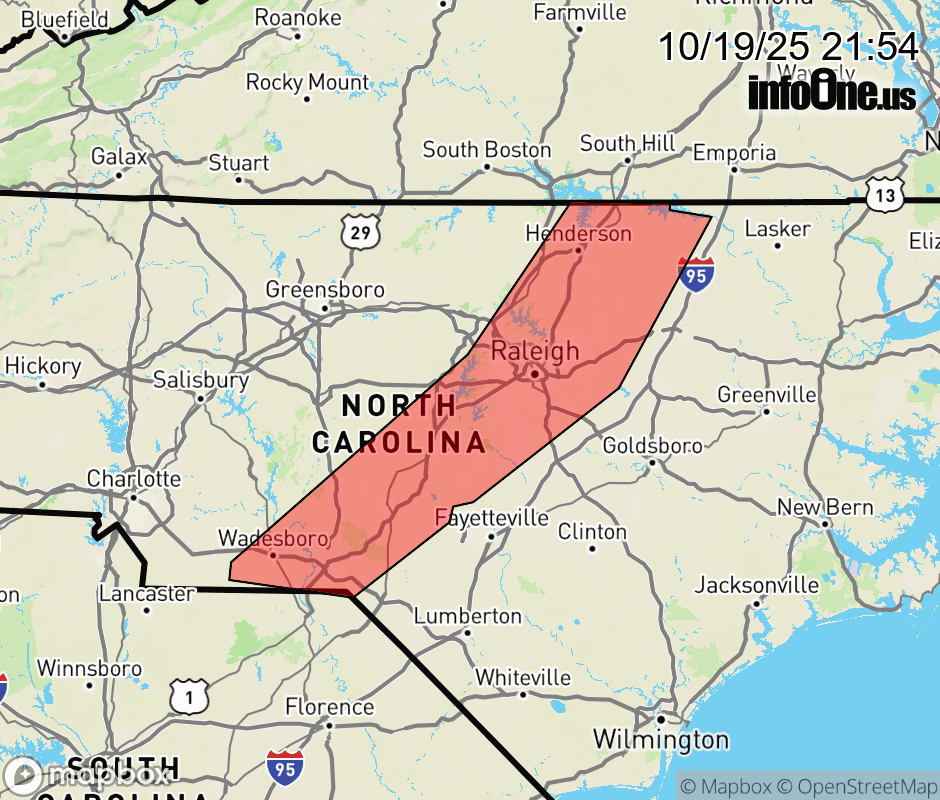 |
|||||||||
 Why aren't you using the InfoOne app? Why aren't you using the InfoOne app?
Stay abreast of information affecting your community! InfoOne tracks real-time information such as:
InfoOne currently supports over 100 communities in NC, VA and WV, and our coverage area is steadily growing. It's free! Install the InfoOne app today and see what you've been missing. |
|||||||||