|
|
Weather Alert |
| Putnam County, WV | |||||||||
|
|
||||||||
|
Canceled 6/11/21 5:30 PM Special Weather Statement issued June 11 at 4:35PM EDT by NWS Charleston WV At 434 PM EDT, radar indicated strong thunderstorms were located along a line extending from near South Charleston to Mount Gay-Shamrock. Movement was southeast at 15 mph. Winds in excess of 30 mph are possible with these storms. Locations impacted include... Charleston, Nitro, Madison, Logan, Jefferson, South Charleston, St. Albans, Dunbar, Sissonville, Chesapeake, Marmet, Oceana, Belle, Chapmanville, Clendenin, Cedar Grove, Poca, East Bank, Glasgow and Pratt. This includes the following highways... Interstate 79 between mile markers 1 and 28. Interstate 77 in West Virginia between mile markers 96 and 117. Interstate 64 in West Virginia between mile markers 42 and 57. West Virginia Turnpike between mile markers 76 and 95. Route 119 between mile markers 29 and 80. Torrential rainfall is also occurring with these storms, and may cause localized flooding. Do not drive your vehicle through flooded roadways. Frequent cloud to ground lightning is occurring with this storm. Lightning can strike 10 miles away from a thunderstorm. Seek a safe shelter inside a building or vehicle. Do not drive your vehicle into areas where the water covers the roadway. The water depth may be too great to allow your car to cross safely. Move to higher ground. 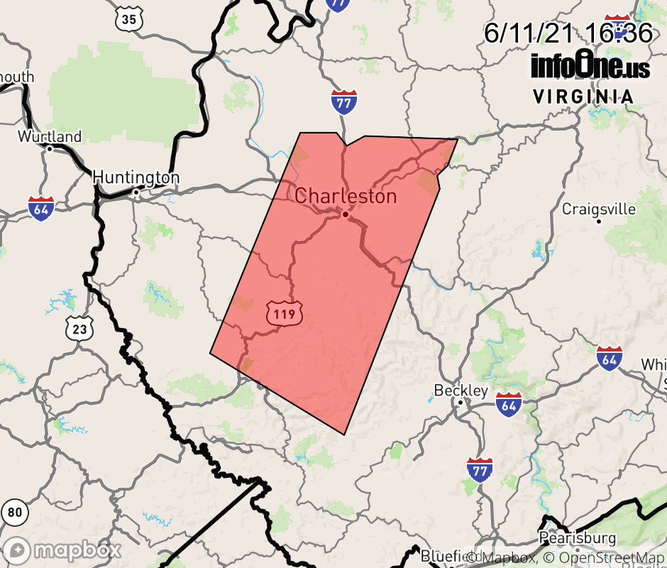 |
|||||||||
 Why aren't you using the InfoOne app? Why aren't you using the InfoOne app?
Stay abreast of information affecting your community! InfoOne tracks real-time information such as:
InfoOne currently supports over 100 communities in NC, VA and WV, and our coverage area is steadily growing. It's free! Install the InfoOne app today and see what you've been missing. |
|||||||||