|
|
Weather Alert |
| Morgan County, WV | |||||||||
|
|
||||||||
|
Canceled 5/14/25 4:44 AM Flood Warning issued May 14 at 12:27AM EDT by NWS Baltimore MD/Washington DC ...The Flood Warning is extended for the following rivers in West Virginia...Maryland... Potomac River at Hancock affecting Washington and Morgan Counties. Potomac River at Shepherdstown affecting Washington, Berkeley and Jefferson Counties. Opequon Creek near Martinsburg affecting Berkeley and Jefferson Counties. ...The Flood Warning continues for the following rivers in West Virginia...Maryland... Potomac River at Paw Paw affecting Morgan, Hampshire and Allegany Counties. Cacapon River near Great Cacapon affecting Morgan County. North Branch Potomac River Near Cumberland affecting Mineral, Hampshire and Allegany Counties. Georges Creek at Westernport affecting Allegany County. Wills Creek near Cumberland affecting Allegany County. For the North Branch Potomac River...including Kitzmiller, Luke, Cumberland...Major flooding is forecast. For the Potomac River...including Paw Paw, Hancock, Shepherdstown, Harpers Ferry, Point of Rocks, Edwards Ferry, Little Falls... Moderate flooding is forecast. For the Wills Creek...including Cumberland...Major flooding is forecast. For the Opequon Creek...including Martinsburg...Minor flooding is forecast. For the Cacapon River...including Great Cacapon...Minor flooding is forecast. * WHAT... Minor flooding is currently forecast. * WHERE... Potomac River at Hancock. * WHEN... From early this morning until further notice. * IMPACTS... At 25.0 feet, Water may begin to inundate low points of the CSX Railroad tracks on the West Virginia side of the river due to backwater. Additionally, access to Potomac Airpark may be restricted due to backwater. Water reaches the top of the Hancock boat ramp and begins to spill over into the adjacent parking lot. * ADDITIONAL DETAILS... - At 12:00 AM EDT Wednesday the stage was 8.8 feet, or 16.2 feet below flood stage. - Forecast...The river is expected to rise to a crest of 25.0 feet just after midnight tonight. - Flood stage is 25.0 feet. - Flood History...This crest compares to a previous crest of 24.9 feet on 02/04/1939. - Please visit www.weather.gov/safety/flood for flood safety and preparedness information 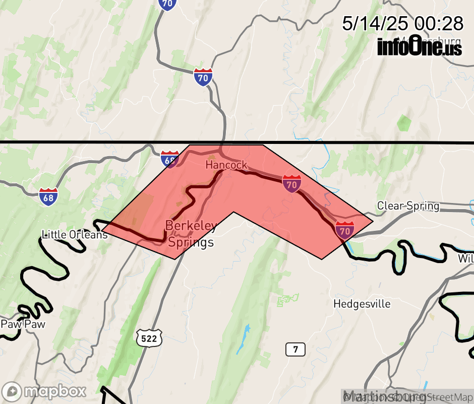 |
|||||||||
 Why aren't you using the InfoOne app? Why aren't you using the InfoOne app?
Stay abreast of information affecting your community! InfoOne tracks real-time information such as:
InfoOne currently supports over 100 communities in NC, VA and WV, and our coverage area is steadily growing. It's free! Install the InfoOne app today and see what you've been missing. |
|||||||||