|
|
Weather Alert |
| Marion County, WV | |||||||||
|
|
||||||||
|
Canceled 6/14/21 7:00 PM Special Weather Statement issued June 14 at 6:33PM EDT by NWS Pittsburgh PA At 633 PM EDT, a strong thunderstorm was located over Barrackville, or over Fairmont, moving southeast at 35 mph. Wind gusts up to 45 mph and hail up to the size of nickels are possible with this storm. Locations impacted include... Fairmont... Pleasant Valley... Winfield... Barrackville... Monongah... Rivesville... Grant Town... Farmington... Baxter... Rachel... Bentons Ferry... Colfax... This includes Interstate 79 in West Virginia between mile markers 132 and 144. Torrential rainfall also is occurring with this storm and may cause localized flooding. Do not drive your vehicle through flooded roadways. 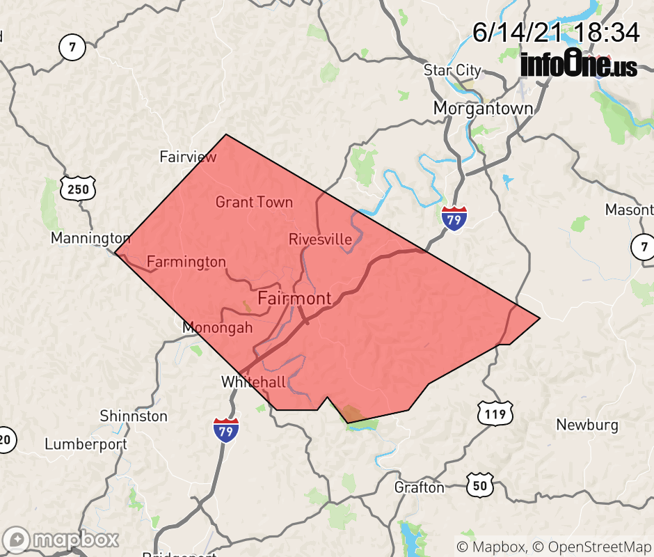 |
|||||||||
 Why aren't you using the InfoOne app? Why aren't you using the InfoOne app?
Stay abreast of information affecting your community! InfoOne tracks real-time information such as:
InfoOne currently supports over 100 communities in NC, VA and WV, and our coverage area is steadily growing. It's free! Install the InfoOne app today and see what you've been missing. |
|||||||||