|
|
Weather Alert |
| Yancey County, NC | |||||||||
|
|
||||||||
|
Canceled 7/18/25 8:00 PM Special Weather Statement issued July 18 at 7:18PM EDT by NWS Greenville-Spartanburg SC At 718 PM EDT, Doppler radar was tracking a cluster of strong thunderstorms 4 miles north of Downtown Asheville, or near Weaverville, moving east at 20 mph. HAZARD...Wind gusts up to 40 mph and half inch hail. SOURCE...Radar indicated. IMPACT...Gusty winds could knock down tree limbs and blow around unsecured objects. Minor hail damage to outdoor objects is possible. Locations impacted include... Downtown Asheville, East Asheville, West Asheville, North Asheville, Black Mountain, Woodfin, Swannanoa, Weaverville, Fairview In Buncombe County, and Biltmore Forest. 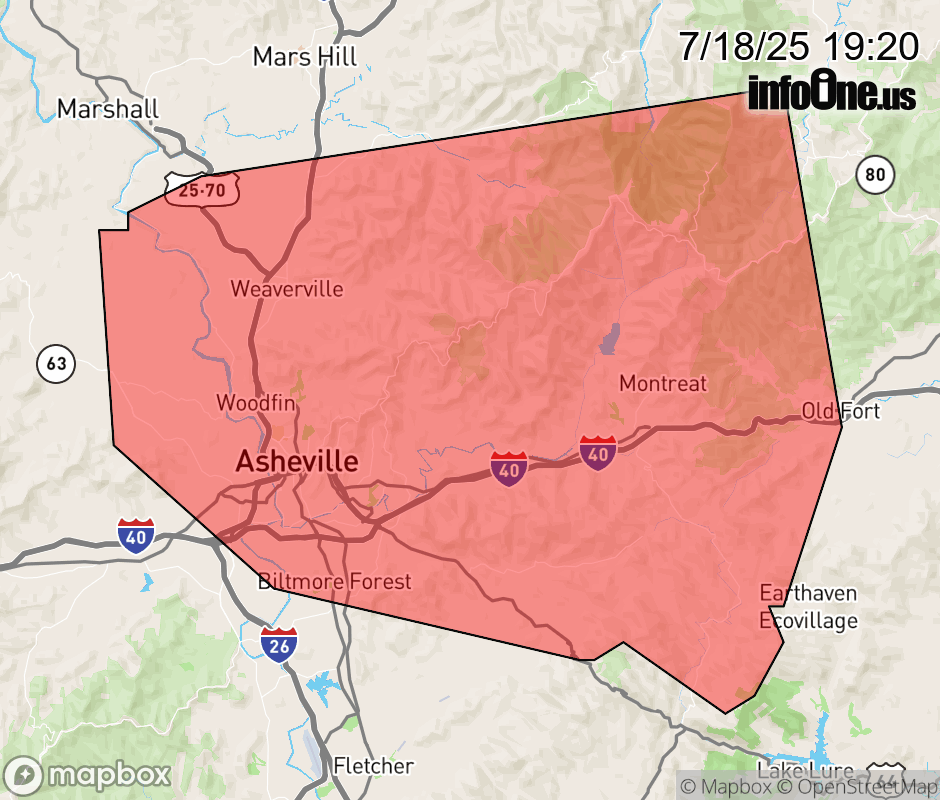 |
|||||||||
 Why aren't you using the InfoOne app? Why aren't you using the InfoOne app?
Stay abreast of information affecting your community! InfoOne tracks real-time information such as:
InfoOne currently supports over 100 communities in NC, VA and WV, and our coverage area is steadily growing. It's free! Install the InfoOne app today and see what you've been missing. |
|||||||||