|
|
Weather Alert |
| Boone County, WV | |||||||||
|
|
||||||||
|
Canceled 2/16/25 11:42 AM Severe Thunderstorm Warning issued February 16 at 11:13AM EST until February 16 at 12:00PM EST by NWS Charleston WV SVRRLX The National Weather Service in Charleston West Virginia has issued a * Severe Thunderstorm Warning for... Nicholas County in southeastern West Virginia... Eastern Kanawha County in central West Virginia... South central Roane County in central West Virginia... North central Raleigh County in southeastern West Virginia... West central Webster County in northeastern West Virginia... Clay County in north central West Virginia... Fayette County in southeastern West Virginia... Northeastern Boone County in central West Virginia... * Until noon EST. * At 1112 AM EST, severe thunderstorms were located along a line extending from 8 miles northwest of Clendenin to 8 miles northeast of Van, moving east at 60 mph. HAZARD...60 mph wind gusts. SOURCE...Radar indicated. IMPACT...Expect damage to roofs, siding, and trees. * Locations impacted include... Pinch, Thurmond, Glasgow, Indore, Drennan, Erbacon, Summersville, Widen, Clay, Ansted, Pratt, Montgomery, Canvas, Birch River, Burnwell, Nettie, Marmet, Handley, Harrison, and Kesslers Cross Lanes. This includes the following highways... Interstate 79 between mile markers 7 and 23. West Virginia Turnpike between mile markers 56 and 90, and mile marker 93 and near mile marker 95. Route 19 between mile markers 8 and 61. 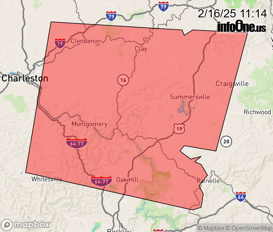 |
|||||||||
 Why aren't you using the InfoOne app? Why aren't you using the InfoOne app?
Stay abreast of information affecting your community! InfoOne tracks real-time information such as:
InfoOne currently supports over 100 communities in NC, VA and WV, and our coverage area is steadily growing. It's free! Install the InfoOne app today and see what you've been missing. |
|||||||||