|
|
Weather Alert |
| Ritchie County, WV | |||||||||
|
|
||||||||
|
Canceled 6/14/21 8:10 PM Severe Thunderstorm Warning issued June 14 at 7:58PM EDT until June 14 at 8:15PM EDT by NWS Charleston WV At 758 PM EDT, a severe thunderstorm was located 7 miles southeast of Harrisville, moving east at 25 mph. HAZARD...60 mph wind gusts and quarter size hail. SOURCE...Radar indicated. IMPACT...Hail damage to vehicles is expected. Expect wind damage to roofs, siding, and trees. Locations impacted include... Glenville, Cedar Creek State Park, Burnsville, Sand Fork, Pullman, Auburn, Smithville, Baldwin, Stouts Mills, Sand Run, Troy, Exchange, Newberne, Alum Bridge, Coxs Mills, Linn, Berea, Tanner, Cedarville and Burnt House. 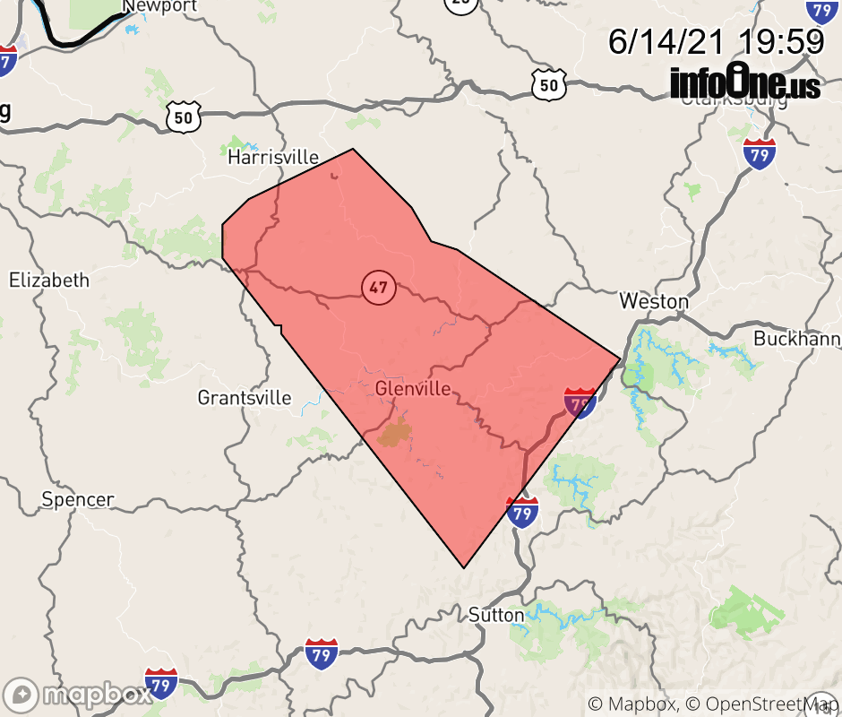 |
|||||||||
 Why aren't you using the InfoOne app? Why aren't you using the InfoOne app?
Stay abreast of information affecting your community! InfoOne tracks real-time information such as:
InfoOne currently supports over 100 communities in NC, VA and WV, and our coverage area is steadily growing. It's free! Install the InfoOne app today and see what you've been missing. |
|||||||||