|
|
Weather Alert |
| Frederick County, VA | |||||||||
|
|
||||||||
|
Canceled 6/18/26 8:32 AM Severe Thunderstorm Warning issued June 18 at 8:14AM EDT until June 18 at 9:00AM EDT by NWS Baltimore MD/Washington DC SVRLWX The National Weather Service in Sterling Virginia has issued a * Severe Thunderstorm Warning for... Northwestern Shenandoah County in northwestern Virginia... Western Frederick County in northwestern Virginia... East central Mineral County in eastern West Virginia... Central Hardy County in eastern West Virginia... Hampshire County in eastern West Virginia... * Until 900 AM EDT. * At 813 AM EDT, severe thunderstorms were located along a line extending from near Romney to 12 miles north of Moorefield to near Petersburg, moving east at 60 mph. HAZARD...60 mph wind gusts. SOURCE...Radar indicated. IMPACT...Damaging winds will cause some trees and large branches to fall. This could injure those outdoors, as well as damage homes and vehicles. Roadways may become blocked by downed trees. Localized power outages are possible. Unsecured light objects may become projectiles. * Locations impacted include... Romney, Wardensville, Springfield, Capon Bridge, Green Spring, Bean Settlement, Yellow Spring, Shanks, High View, Bloomery, Perry, Points, Lost City, Lost River, Delray, Cross Junction, Baker, Kirby, Gore, and Wapocomo. 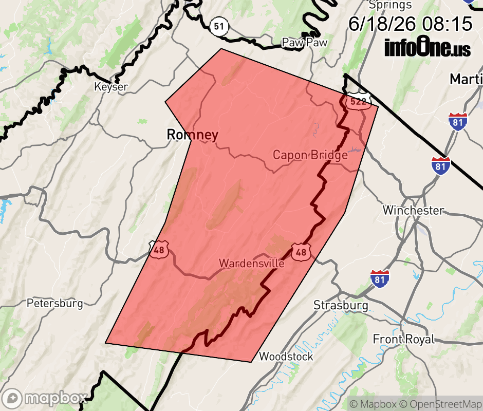 |
|||||||||
 Why aren't you using the InfoOne app? Why aren't you using the InfoOne app?
Stay abreast of information affecting your community! InfoOne tracks real-time information such as:
InfoOne currently supports over 100 communities in NC, VA and WV, and our coverage area is steadily growing. It's free! Install the InfoOne app today and see what you've been missing. |
|||||||||