|
|
Weather Alert |
| Summit County, OH | |||||||||
|
|
||||||||
|
Canceled 6/5/25 4:30 PM Special Weather Statement issued June 5 at 3:43PM EDT by NWS Cleveland OH At 342 PM EDT, Doppler radar was tracking a strong thunderstorm near Wooster, moving northeast at 10 mph. HAZARD...Wind gusts up to 50 mph and half inch hail. SOURCE...Radar indicated. IMPACT...Gusty winds could knock down tree limbs and blow around unsecured objects. Minor hail damage to vegetation is possible. Locations impacted include... Akron, Canton, Wooster, Cuyahoga Falls, Massillon, Barberton, Green, Wadsworth, Tallmadge, Orrville, Rittman, Doylestown, Creston, Brewster, Navarre, Dalton, Shreve, Mount Eaton, New Franklin, and Norton. 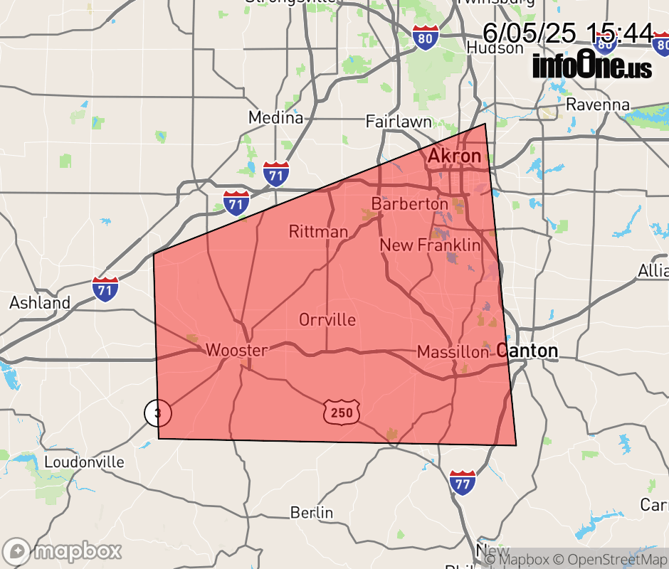 |
|||||||||
 Why aren't you using the InfoOne app? Why aren't you using the InfoOne app?
Stay abreast of information affecting your community! InfoOne tracks real-time information such as:
InfoOne currently supports over 100 communities in NC, VA and WV, and our coverage area is steadily growing. It's free! Install the InfoOne app today and see what you've been missing. |
|||||||||